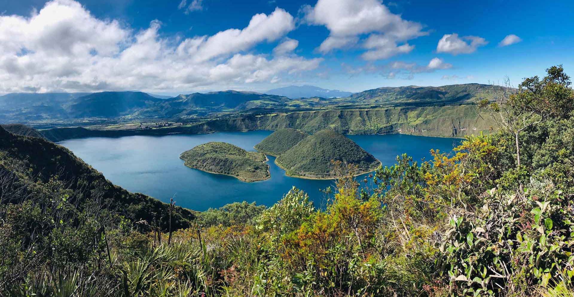
The more recent active volcanic domes of Wolf (right) and Yerovi (left) islands emerge in the middle of Cuicocha caldera lake. Photo taken from the south flank of Cotacachi volcano.
Geological Period
Cuaternary / Pleistocene
Main geological interest
Volcanology.
Geomorphology and active geological processes.
The more recent active volcanic domes of Wolf (right) and Yerovi (left) islands emerge in the middle of Cuicocha caldera lake. Photo taken from the south flank of Cotacachi volcano.
Volcanic complex with a spectacular 3 km wide active volcanic caldera, with many documented records of violent historical eruptions.
The Cotacachi-Cuicochoa volcanic complex (CCVC) is one of the most powerful volcanoes in Ecuador. Its activity during the last 3100 years includes the destruction of a pre-caldera dome due to violent eruptions with pyroclastic waves. After the formation of the caldera, there was a lava extrusion that formed the two islands that are visible today within the caldera and its accumulation of glacial water, forming Lake Cuicocha. It is currently the most visited tourist attraction offered by the Global Geopark Imbabura UNESCO with around 200,000 visitors a year due to its easy access and beauty.
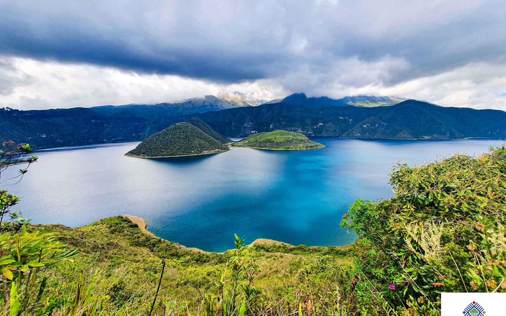
Partially covered by clouds, in the background Cotacachi volcano is visualized.
Geological description
The Cotacachi – Cuicocha volcanic complex is a Geosite of the Imbabura UNESCO Global Geopark with a base area of approximately 268 km2 . The CVCC consists of a central building (Cotacachi volcano; maximum summit= 4939 m a.s.l.), four satellite domes (Cuicocha, Muyurcu, Loma Negra and Piribuela) and a volcanic caldera (Cuicocha caldera).
The Cotacachi Volcano is an extinct stratum-volcano, and two large avalanches of debris are evidenced of its evolution. The first is associated with the closure of the formation of the first volcanic building that occurred between 162 and 108 thousand years BP.
According to the stratigraphic position, it is estimated that the second avalanche of rubble occurred between 102 and 65 thousand years BP, being part of the development of the second volcanic building. The closure of Cotacachi II is marked by a sequence of lava flows that fill the crater. It is considered that satellite domes began to form from 44 thousand BP years.
The Cuicocha caldera, wich represents the most recent phase of the complex, has presented at least two phases of activity in 3100 and 2900 years BP (Hillebrant, 1989), which makes it a potentially active volcano.
Scientific research and tradition
Since 2011, the EPN Geophysical Institute has been constantly monitoring the volcano, and since 2016 it has published annual reports. Since 2019 it has been producing quarterly reports of CO2 and seismic activity, showing its importance in risk management. Many universities use Cuicocha to conduct geological, biological and risk management research.
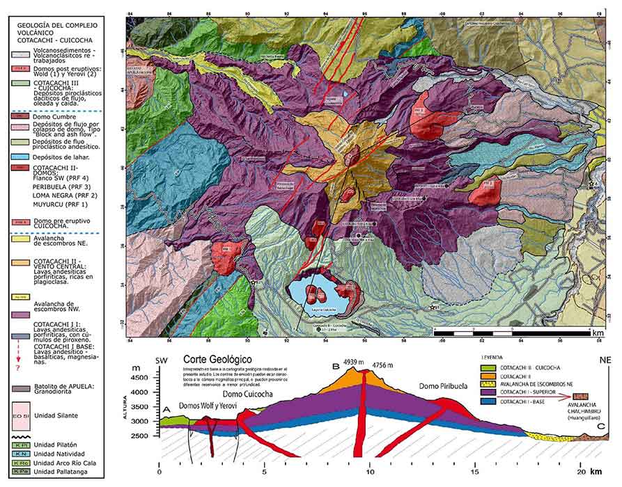
Geological map and cross-section of the Cotacachi-Cuicocha Volcanic Complex (Imbabura UGGp).
Reference
Almeida, M. et al. (2019) ‘New constraints on the geological and chronological evolution of the Cotacachi-Cuicocha Volcanic Complex (Ecuador)’, in 8th International Symposium on Andean Geodynamics (ISAG). Available at: https://hal.archives-ouvertes.fr/hal-02419525.
Gunkel, G. et al. (2009) ‘Survey and assessment of post volcanic activities of a young caldera lake, Lake Cuicocha, Ecuador’, Natural Hazards and Earth System Sciences, 9(3), pp. 699–712.
Hillebrandt, C. (1989) Estudio geovolcanológico del complejo volcánico Cuicocha – Cotacachi y sus aplicaciones, Provincia de Imbabura. Quito. Tesis de Maestría. Escuela Politécnica Nacional.
Rengel Calvopiña, P.J. (2020) Characterization of pyroclastic density current deposits at Cuicocha caldera volcano, northern ecuadorian Andes. Bachelor’s Thesis. Universidad de Investigación de Tecnología Experimetal Yachay. Available at: http://repositorio.yachaytech.edu.ec/handle/123456789/186.
Sierra, D. et al. (2021) ‘Temporal and spatial variations of CO2 diffuse volcanic degassing on Cuicocha Caldera Lake – Ecuador’, Journal of Volcanology and Geothermal Research, 411, p. 107145. Available at: https://doi.org/10.1016/j.jvolgeores.2020.107145.
Author(s)
Carlos Merizalde
Coordinator – Imbabura UNESCO Global Geopark
Carlos Ubidia
Geologist – Imbabura UNESCO Global Geopark
Mario Ruiz
Volcanologist, Geophysical Institute – EPN