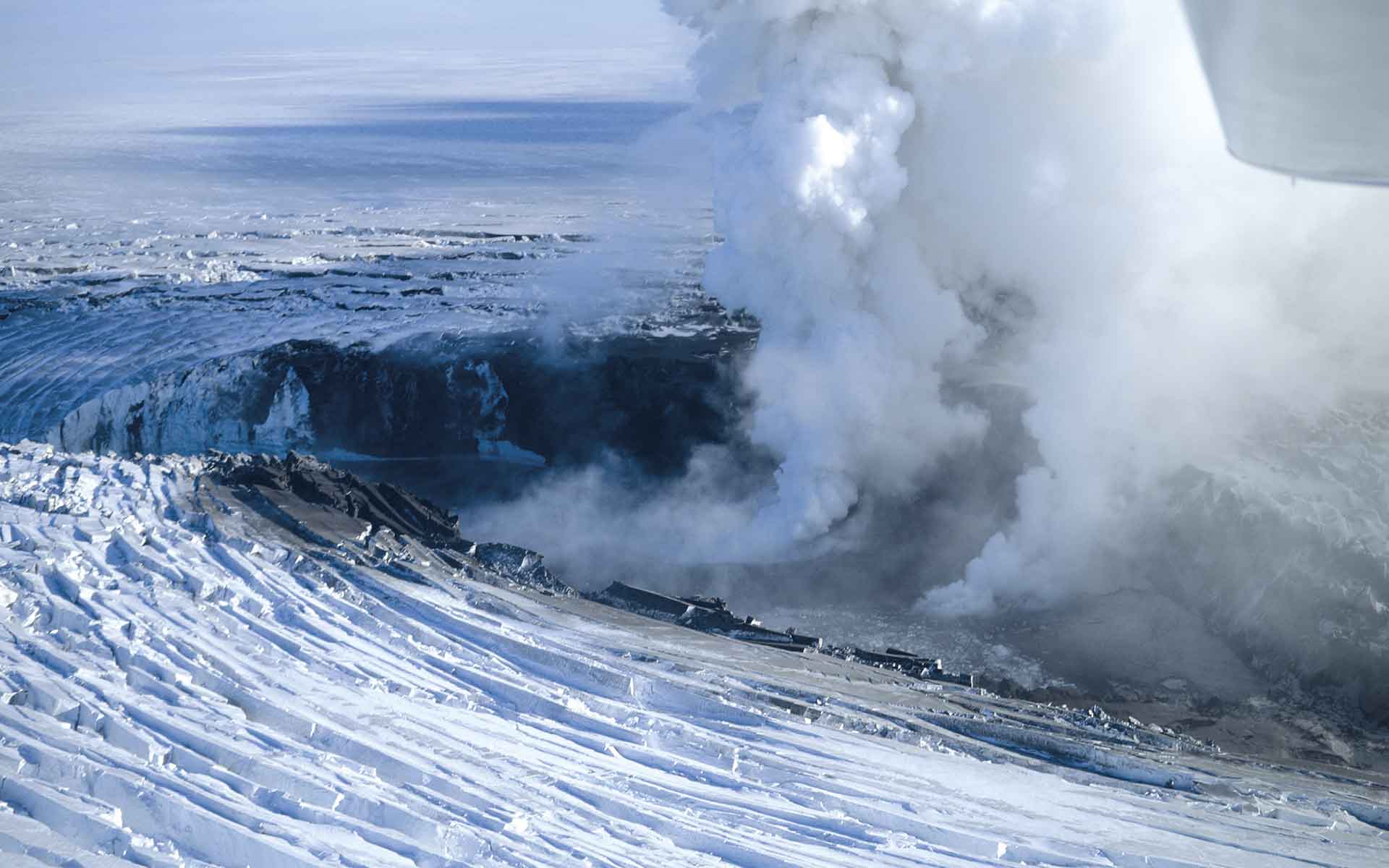
Subglacial eruption of Gjálp volcano in northwestern part of the Vatnajökull glacier (3 October 1996). Copyright Oddur Sigurðsson, Icelandic Meteorological Office.
Geological Period
Quaternary
Main geological interest
Geomorphology and active geological processes
Volcanology
Location
Vatnajökull, Iceland
64°34’39”N, 016°52’54”W
Subglacial eruption of Gjálp volcano in northwestern part of the Vatnajökull glacier (3 October 1996). Copyright Oddur Sigurðsson, Icelandic Meteorological Office.
Unique landscape forged by the constant conflict between fire and ice in the rift zone at the divergent plate tectonics.
Vatnajökull is an outstanding example representing interactions between volcanism and glaciation (Baldursson et al., 2018). The most spectacular are the jökulhlaups – sudden floods caused by glacier margin breaches during an eruption with a huge water discharges. This recurrent phenomenon has led to the formation of unique sandur plains, among the best of their kind in the world (Magilligan et al., 2002; Thórhallsdóttir and Svavarsdóttir, 2022), braided channel systems and rapidly evolving canyons. Vatnajökull also illustrates different types of glaciation, from ice cap to outlet glaciers, and glacial landforms around the ice cap provide evidence of ice advance and retreat.
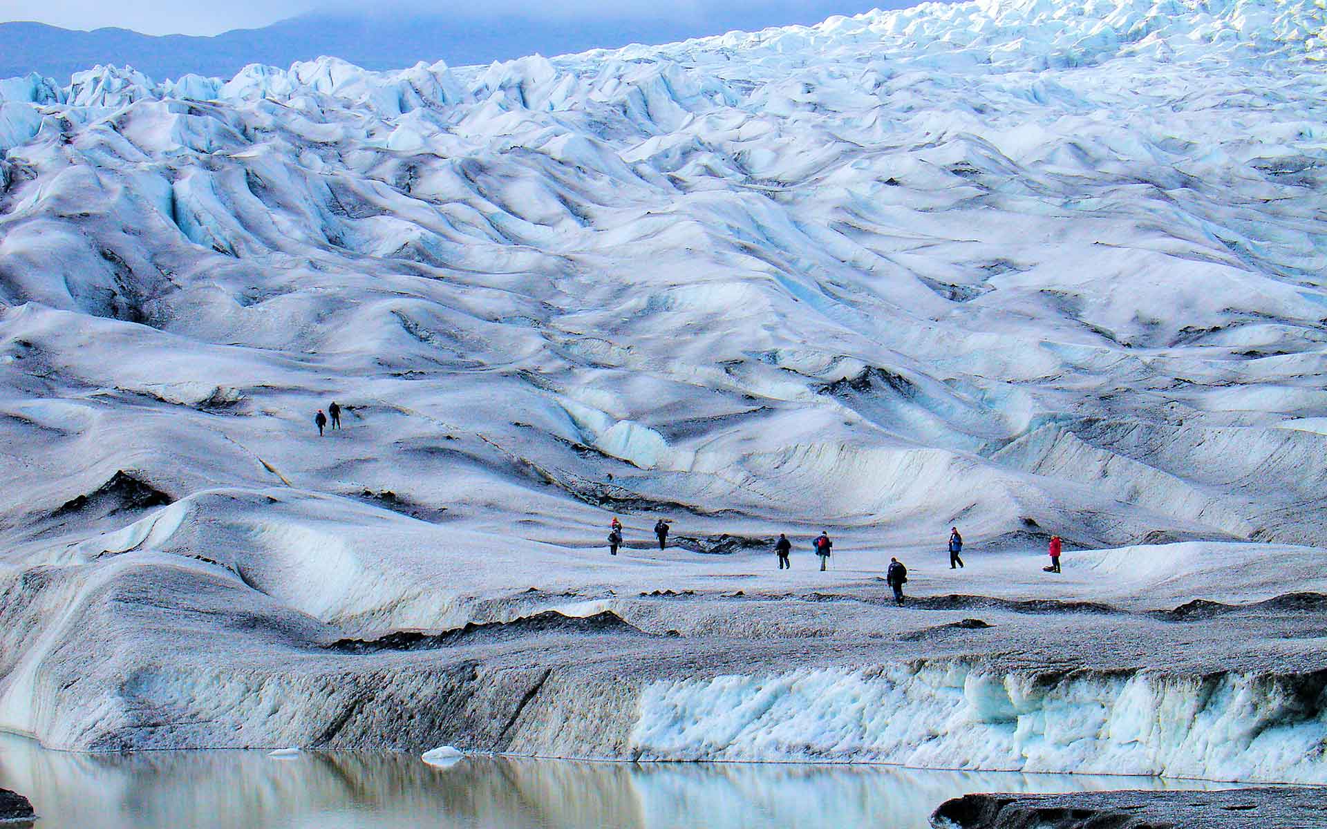
Waving front of Fláajökull – one of the 40 outflow glaciers in the south-eastern part of Vatnajökull ice cap. Photo by Zbigniew Zwoliński.
Geological description
This area covers almost 10% of Iceland’s territory and is characterised by the coexistence and ongoing interaction of an active oceanic rift on land, a mantle plume, and an ice cap that have varied in size and extent over the past 2.8 million years. Earth system interactions are constantly modifying this area, creating remarkably diverse landscapes and a wide variety of plate-tectonic, volcanic and glaciovolcanic features. There are eight subglacial volcanoes. Some of them are among the most active in Iceland (e.g. Grímsvötn, Bárðarbunga; Gudmundsson, 2004). Particulary interesting and unique in this regard are the basaltic lava shields, volcanic fissures and cone rows, vast flood lavas, and features of ice-dominanted glacio-volcanism, such as tuyas and tindars. Geothermal heat and subglacial eruptions produce meltwater and jökulhlaups that maintain globally unique sandur plains, to the north and south of the Vatnajökull ice cap (~8000 km2), as well as rapidly evolving canyons. In addition, the area contains a dynamic set of glaciological and geomorphological features, created by 40 expanding or retreating outlet glaciers in response to climate change. These features can be easily accessed and explored at the snouts of Vatnajökull’s many glaciers and their forelands, especially in the southern lowlands (e.g., Skeiðarársandur).
Scientific research and tradition
The pioneering descriptions of the Vatnajökull glacier were made by the Finnish geologist Jöns Svanberg in 1794. In the late 19th century, interest began to focus on the relationship between the geology and dynamics of the Vatnajökull glacier in an attempt to understand how the glacier responds to climate change.
Vatnajökull is the greatest mass of ice in Europe with 40 outlet glaciers, 8 active volcanoes and vast outwash plain of the Skeiðarársandur (1300 km2).
Reference
Baldursson, S. et al. (2018) Nomination of Vatnajökull National Park for inclusion in the World Heritage List. Reykjavík: Vatnajökull National Park.
Gudmundsson, M.T. et al. (2004) ‘The 1996 eruption at Gjálp, Vatnajökull ice cap, Iceland: efficiency of heat transfer, ice deformation and subglacial water pressure’, Bulletin of Volcanology, 66(1), pp. 46–65. Available at: https://doi.org/10.1007/s00445-003-0295-9.
Thórhallsdóttir, T.E. and Svavarsdóttir, K. (2022) ‘The Environmental History of Skeiðarársandur Outwash Plain, Iceland’, Journal of the North Atlantic, 2022(43), pp. 1–21. Available at: https://doi.org/10.3721/037.006.4303.
Author(s)
Zbigniew Zwoliński.
Institute of Geoecology and Geoinformation, Adam Mickiewicz University in Poznań, Poland.
Malgorzata Mazurek.
Institute of Geoecology and Geoinformation, Adam Mickiewicz University, Poznan, Poland.