Early Cretaceous Rhyolitic Columnar Rock Formation of Hong Kong
CHINA
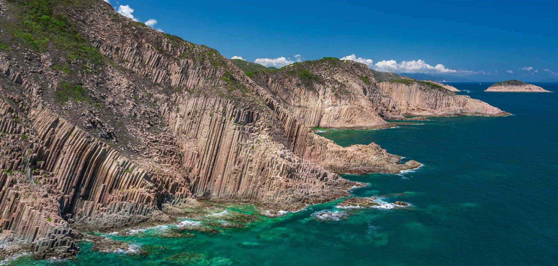
Photograph showing the typical geomorphological feature of the High Island Formation.
Geological Period
Early Cretaceous
Main geological interest
Igneous and metamorphic petrology
History of geosciences
Volcanology
Location
Sai Kung, Hong Kong, China.
22°21’21.0″N, 114°22’13.0″E
Photograph showing the typical geomorphological feature of the High Island Formation.
One of the most spectacular rhyolitic columnar rock formations in the world.
The High Island Formation is the relic of an early Cretaceous supervolcano, which had produced a massive amount of 1,300km3 volcanic ash (Sewell et al., 2019). Columnar joints were developed by thermal contraction in the ash deposited within the caldera. The rock formation is different from mafic volcanic rock columns found elsewhere in the world. It was developed from felsic rhyolitic rock with up to 76% SiO2 content (Strange et al., 1990). The entire formation displays an extremely high degree of homogeneity in lithology, petrology and geochemistry (Strange et al., 1990). And this formation is integrated with diverse coastal erosion and deposition landforms, such as sea cliffs, sea notches, sea caves, sea arches, sandy and pebble beaches. The site presents a rare geomorphological landscape.
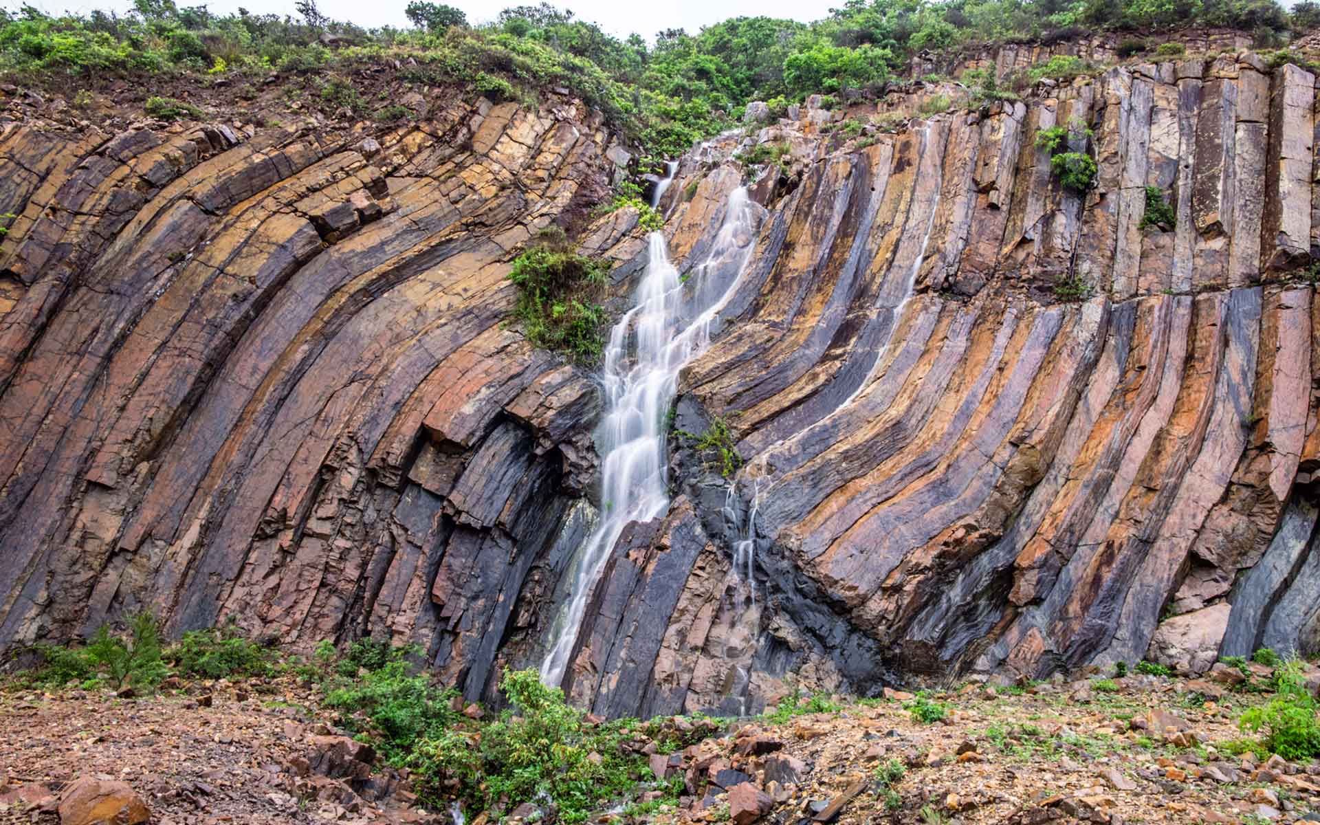
Photograph showing deformation structure, and a mafic dyke intrusion (white arrow) cutting the deformed rhyolitic columns.
Geological description
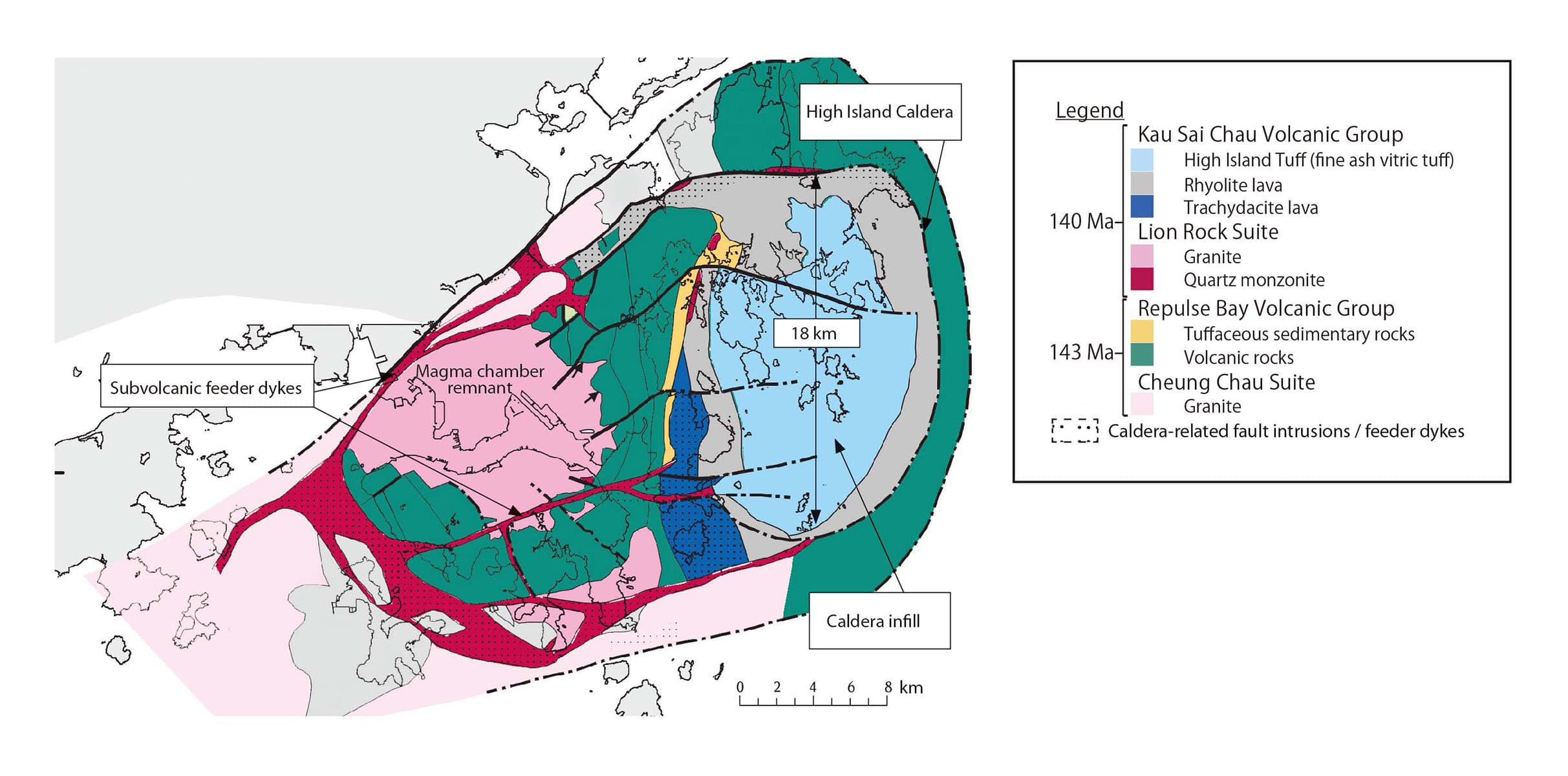
The columnar rock formation (140-141 Ma.), called the High Island Formation, is widely exposed along the coast, cliffs and numerous islands in Sai Kung, Hong Kong. The formation occurs as a wide-spread sheet of about 100km2 and up to 400m in thickness (Strange et al., 1990) in a giant caldera complex (Sewell et al., 2012). The average column diameter is 1.2m, with the largest specimens measuring 3m. Sai Kung is characterised by long meandering coastlines and numerous islands. In this setting, the hexagonal rock columns are well exposed. The shores are rimmed with steep sea cliffs; at some points, the columns stand up to 100m above sea level. It is the most iconic and globally rare geological heritage of the Hong Kong UNESCO Global Geopark.
Scientific research and tradition
Comprehensive studies on this rock formation started as early as 1926 and continue at the present. Geologists have reconstructed remarkable details about the eruption history and the geometry of the nested caldera complex, making this rock formation the most significant geological heritage in Hong Kong and the most well studied formation of its kind in the world. The formation has been a part of Hong Kong UNESCO Global Geopark since 2009.
Geologic map of the nested caldera complex showing key stratigraphic units, faults and tectonomagmatic boundary elements associated with the High Island Formation (in light blue).
Reference
Sewell, R.J. and Campbell, S.D.G. (1997) ‘Geochemistry of coeval Mesozoic plutonic and volcanic suites in Hong Kong’, Journal of the Geological Society, 154(6), pp. 1053–1066. Available at: https://doi.org/10.1144/gsjgs.154.6.1053.
Sewell, R.J., Tang, D.L.K. and Campbell, S.D.G. (2012) ‘Volcanic-plutonic connections in a tilted nested caldera complex in Hong Kong’, Geochemistry, Geophysics, Geosystems, 13(1). Available at: https://doi.org/10.1029/2011GC003865.
Sewell, R.J., Tang, D.L.K. and Sin, Y.M. (no date) Hong Kong’s Big Bang – The Discovery of High Island Supervolcano. Hong Kong: Civil Engineering and Development Department, pp. 16, – 18, 21–23, 26–28, 33, 36–40. Available at: https://hkss.cedd.gov.hk/hkss/eng/education/GS/others/HKs Big Bang.pdf.