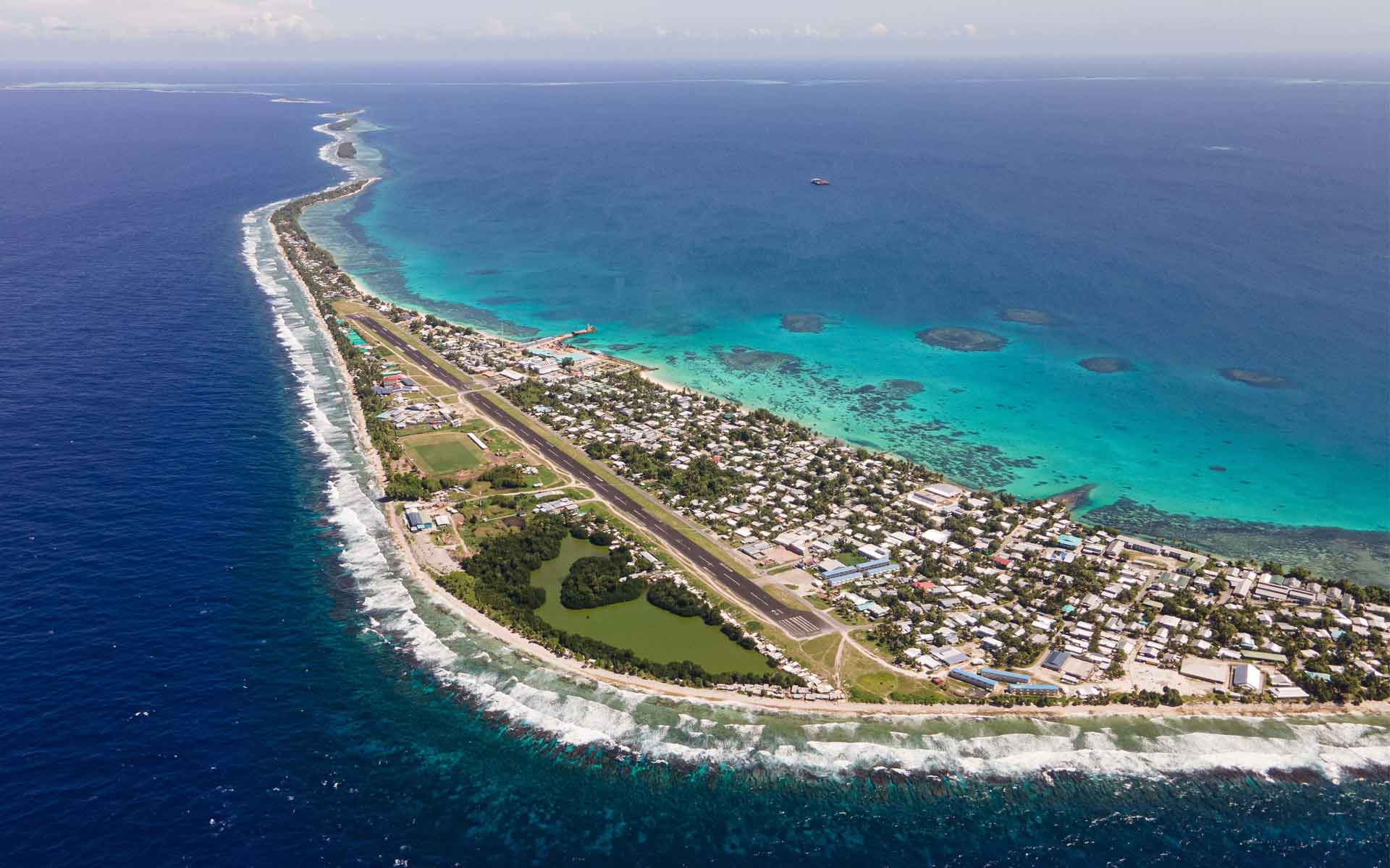
Aerial image of Fongafale Islet (main islet of Funafuti Atoll), looking southwest.
The site where Charles Darwin’s subsidence theory of atoll formation was first tested.
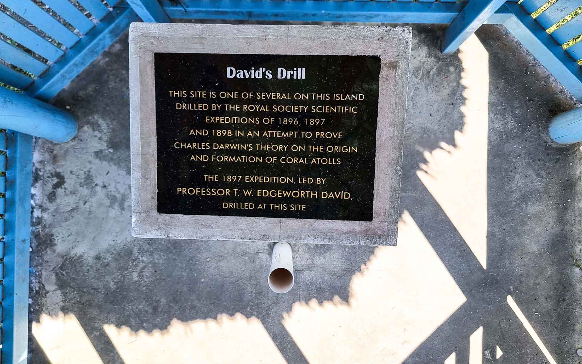
Funafuti Atoll is an internationally significant site with substantial contributions to the geological sciences, through the rich history associated with the first drilling experiment to test Darwin’s subsidence theory of atoll formation (Armstrong et al., 1904). This internationally significant drilling site reflects interaction between atoll carbonate sedimentation, dolomite formation, tectonic subsidence and eustatic sea-level change (Ohde et al., 2002). The site is proudly conserved as ‘Te Vili O Tavita’ (‘David’s Drill’), named after the geologist Sir Edgeworth David who led the 1897-expedition. Additionally, Funafuti has the oldest, most comprehensive geological maps of any atoll globally, that provide a unique dataset for on-going contributions to the geological sciences.
Commemorative plaque installed at the location of ‘David’s Drill’, which reached a depth of 1114 ft in 1898.
Geological description
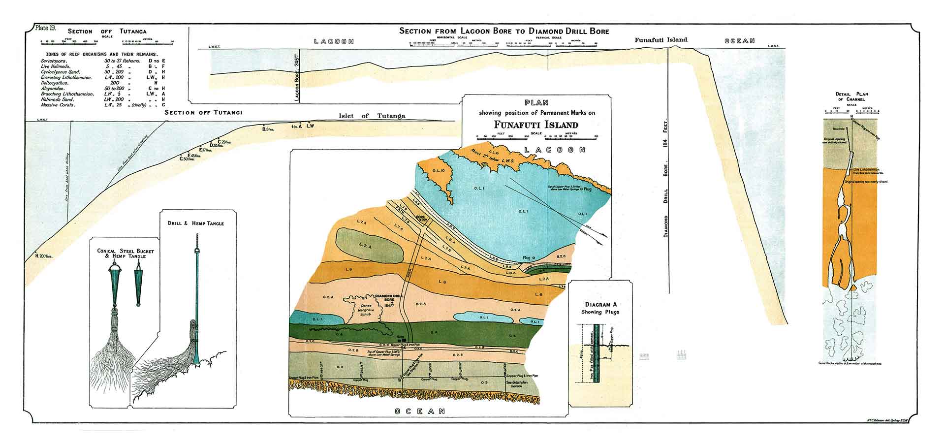
The origin of atolls was a mystery to science and source of great debate since the pioneering days of modern geoscience. Following observations made during the voyage of HMS Beagle, Charles Darwin proposed a revolutionary theory that atolls formed as the result of oceanic volcanic islands undergoing prolonged subsidence, together with upward growth of reef-constructing coral formation (Darwin, 1842; Armstrong et al., 1904). To test this theory, the Royal Society sponsored three expeditions to Funafuti Atoll between 1896- 1898 and completed a drilling experiment which sampled the subsurface geology of the atoll (Armstrong et al., 1904). The deepest core recovered over 300m of shallow-water carbonates, which provided sufficient evidence to satisfy the principal of Darwin’s theory (Armstrong et al., 1904; Ohde et al., 2002). Analysis of the core suggested a subsidence rate of 30m/Ma, with the Pleistocene-Pliocene boundary at a depth of ca 200m and the deepest dolomite with 2.3 Ma. Subsequent seismic reflection and bathymetric interpretation indicates the underlying volcanic basement is approximately 600m below sea level and the crustal age under Funafuti is estimated ca 110 Ma (Gaskell and Swallow, 1953; Krüger, 2008). During the 1897 expedition the team also produced the most detailed geological maps and cross sections of any atoll (Armstrong et al., 1904). The maps remain an internationally unparalleled baseline dataset to study atoll morphological changes resulting from coastal processes, anthropogenic influences, and climate change.
Scientific research and tradition
Darwin first proposed his subsidence theory of atoll formation in the book Structure and Distribution of Coral Reefs (Darwin, 1842). He outlined an experiment to test his theory which was carried out on Funafuti Atoll between 1896-1898 (Armstrong et al., 1904). His theory has since been recognized globally and further developed by works from other notable scholars (Gaskell and Swallow, 1953; Stoddart, 1969; Ohde et al., 2002; Krüger, 2008).
One of the first detailed geological maps of an atoll ever produced, showing the position and cross section of David’s Drill (Diamond Drill Bore) and other boring sites.
Reference
Armstrong, H.E. et al. (1904) The atoll of Funafuti; borings into a coral reef and the results, being the report of the Coral Reef Committee of the Royal Society. London, The Royal Society of London. Available at: http://archive.org/details/atolloffunafutib00roya (Accessed: 22 July 2022).
Darwin, C. (1842) The Structure and Distribution of Coral Reefs: Being the First Part of the Geology of the Voyage of the Beagle, under the Command of Capt. Fitzroy, R.N. during the Years 1832 to 1836. London: Smith, Elder and Co (Cambridge Library Collection – Earth Science). Available at: https://doi.org/10.1017/CBO9781107325098.
Gaskell, T.F. and Swallow, M.A. (1953) Seismic experiments on two Pacific atolls. F.J. Milner (Occasional papers of the Challenger Society, 3).
Krüger, J. (2008) High-Resolution Bathymetric Survey of Tuvalu. Suva: Pacific Islands Applied Geoscience Commission.
Ohde, S. et al. (2002) ‘The chronology of Funafuti Atoll: revisiting an old friend’, Proceedings of the Royal Society of London. Series A: Mathematical, Physical and Engineering Sciences, 458(2025), pp. 2289–2306. Available at: https://doi.org/10.1098/rspa.2002.0978.
Sapolu Tetoa
Lands and Survey Department, Office of the Prime Minister, Tuvalu
Faatasi Malologa
Lands and Survey Department, Office of the Prime Minister, Tuvalu
Gary Lee
The Pacific Community (SPC), Fiji
Dana Tigarea
The Pacific Community (SPC), Fiji
Roger F. Mclean
University of New South Wales, Australia
Károly Németh
Massey University, New Zealand; Institute of Earth Physics and Space Science, Hungary and Saudi Geological Survey, Kingdom of Saudi Arabia
Benjamin van Wyk de Vries
Université Clermont Auvergne, Laboratoire Magmas et Volcans, OPGC, CNRS et IRD, Clermont Ferrand, France