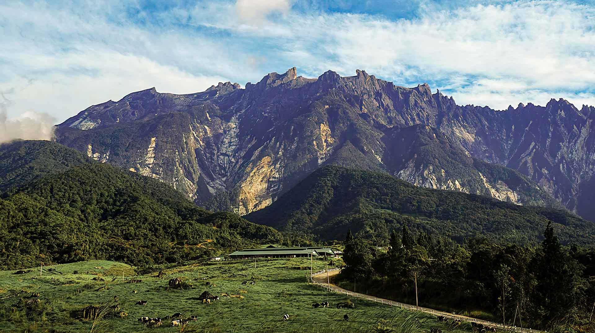
Granitic pluton of Mount Kinabalu seen from Kundasang. The hilly foreground is made up of sedimentary rocks of the Crocker Formation; the flat area in front is made up of glacial deposits of the Pinousuk Gravels.
Geological Period
Late Miocene – Pliocene
Main geological interest
Igneous and metamorphic petrology
Geomorphology and active geologic processes
Location
Mount Kinabalu is located in the state of Sabah, Malaysia.
6°04’31.0″N, 116°33’32.0″E
Granitic pluton of Mount Kinabalu seen from Kundasang. The hilly foreground is made up of sedimentary rocks of the Crocker Formation; the flat area in front is made up of glacial deposits of the Pinousuk Gravels.
One of the youngest granitic intrusions exposed on Earth and the site of spectacular tropical glacial landscapes.
Mount Kinabalu Neogene Granite is the youngest granitic pluton in the world. Its age dating indicates that the cooling of the magma ranged from 8 to 7 million years ago. The igneous intrusion into the accreted ophiolitic and sedimentary rocks may be related to the subduction of the Proto South China Sea plate under southeast Borneo. The glacial processes on top of Mount Kinabalu during the last Ice Age created the most spectacular glacial landscape in the tropics. At the foothills of Mount Kinabalu, on the Pinousuk Plain, are the most extensive tilloid deposits in Southeast Asia, as young as 10,000 years old.
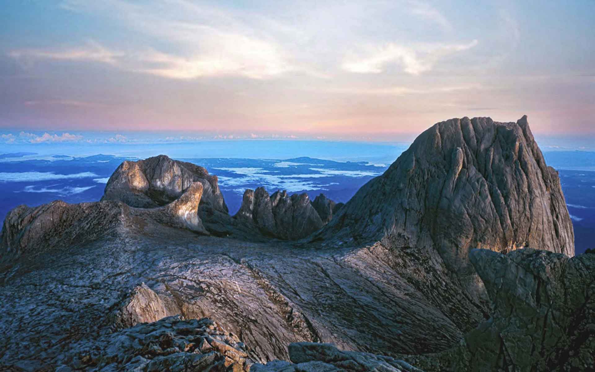
Glacial erosion landforms at the Mount Kinabalu plateau include cirque, remnant peaks and striated surfaces.
Geological description
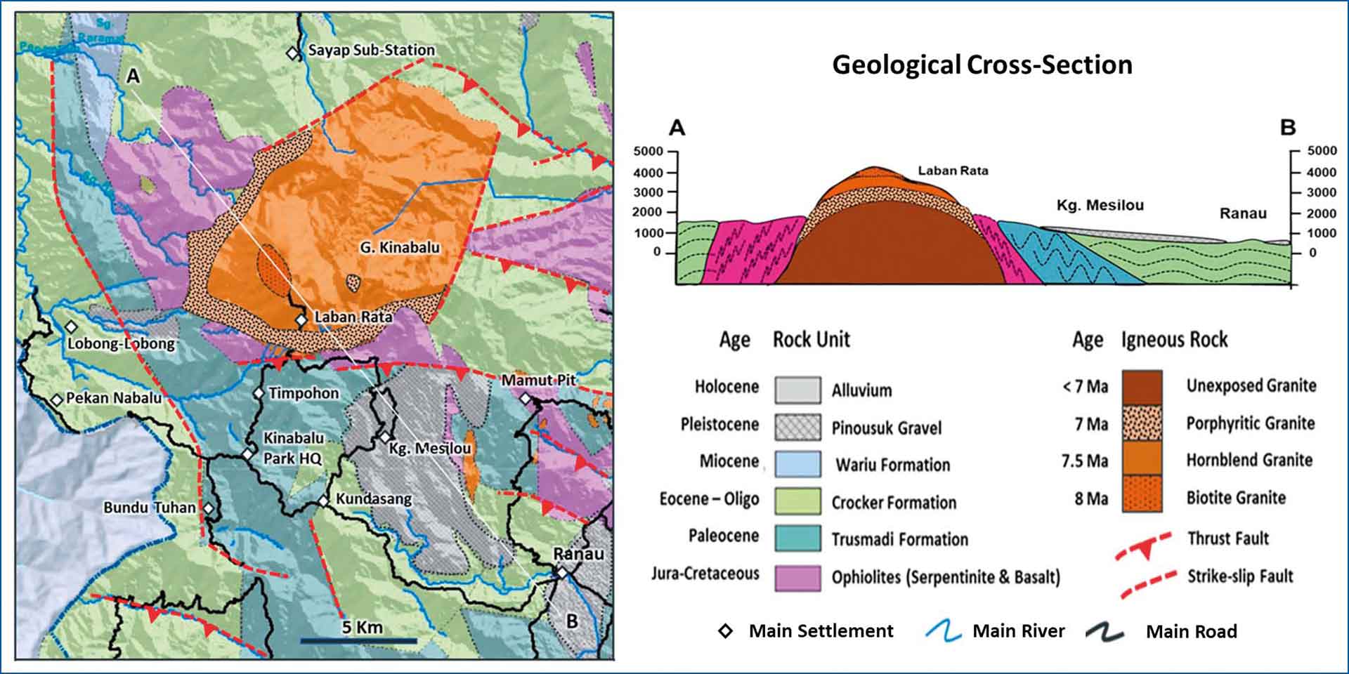
Mount Kinabalu is the youngest granitoid intrusion in Southeast Asia. U–Pb ages from zircon ranged between 8 and 7 million years (Cottam et al., 2010). The granitic body intrudes ultrabasic rocks and sedimentary rocks of the Trusmadi and Crocker Formations. It was emplaced in a regional extension setting (Burton-Johnson et al., 2017) after the ultrabasic basement and sedimentary rocks were accreted (Hall, 2013). Igneous thermochronometry gave an upper to mid-crustal emplacement depth of 7–12 km (Cottam et al. 2013). The plutonic body is exposed at an elevation of around 4000 m. The rapid uplift of the area is thought to be associated with the removal of a dense lithospheric root under Sabah about 8 million years ago (Hall et al., 2009). The pluton has two phases: the outer part consists of coarse-grained porphyritic granite, whereas the main body consists of finer-grained hornblende granite and biotite granite. The landscape of Mount Kinabalu was shaped by glacial processes during the Quaternary (Koopmans and Stauffer, 1967). Rocks eroded from the mountain were deposited as the Pinousuk Gravels at Mesilou Plain. The erosion created the east and west plateaus and peaks such as Low’s Peak (4,101 m) and St. John’s Peak (4,098 m).
Scientific research and tradition
Mount Kinabalu has been the focus of scientific research since the 1960s. Geological studies were mostly carried out by the Geological Survey of Malaysia (North Borneo). Systematic mapping of geoheritage sites started in 1996. To date, over 300 projects by researchers from all over the world have been conducted here.
A geological map of the Mount Kinabalu area showing the distribution of rock units and major tectonic structures. The granite pluton intrudes into the accreted Mesozoic ophiolitic basement rock and overlying Paleogene turbidite sediments. Tilloid deposits of the Pinousuk Gravel occur on the southeastern part of the mountain.
Reference
Burton-Johnson, A., Macpherson, C.G. and Hall, R. (2017) ‘Internal structure and emplacement mechanism of composite plutons: evidence from Mt Kinabalu, Borneo’, Journal of the Geological Society, 174(1), pp. 180–191. Available at: https://doi.org/10.1144/jgs2016-041.
Cottam, M. et al. (2010) ‘Pulsed emplacement of the Mount Kinabalu granite, northern Borneo’, Journal of the Geological Society, 167(1), pp. 49–60. Available at: https://doi.org/10.1144/0016-76492009-028.
Cottam, M.A. et al. (2013) ‘Neogene rock uplift and erosion in northern Borneo: evidence from the Kinabalu granite, Mount Kinabalu’, Journal of the Geological Society, 170(5), pp. 805–816. Available at: https://doi.org/10.1144/jgs2011-130.
Hall, R. et al. (2009) The geology of Mount Kinabalu. (Sabah Parks Publication, 13).
Hall, R. (2013) ‘Contraction and extension in northern Borneo driven by subduction rollback’, Journal of Asian Earth Sciences, 76, pp. 399–411. Available at: https://doi.org/10.1016/j.jseaes.2013.04.010.
Koopmans, B.N. and Stauffer, P.H. (1967) ‘Glacial phenomena on Mount Kinabalu, Sabah.’, Geological Survey of Malaysia, Borneo Region Bulletin, 8, pp. 25–35.
Author(s)
Ibrahim Komoo
Emeritus Professor of Engineering Geology at the Institute of Environment and Development (LESTARI), Universiti Kebangsaan Malaysia
Felix Tongkul
Honorary Professor of Geology at the Faculty of Science and Natural Resources, Universiti Malaysia Sabah (UMS)
Che Aziz Ali
Professor of Sedimentology, Universiti Kebangsaan Malaysia
Norhayati Ahmad
Professor of Biology at Universiti Kebangsaan Malaysia