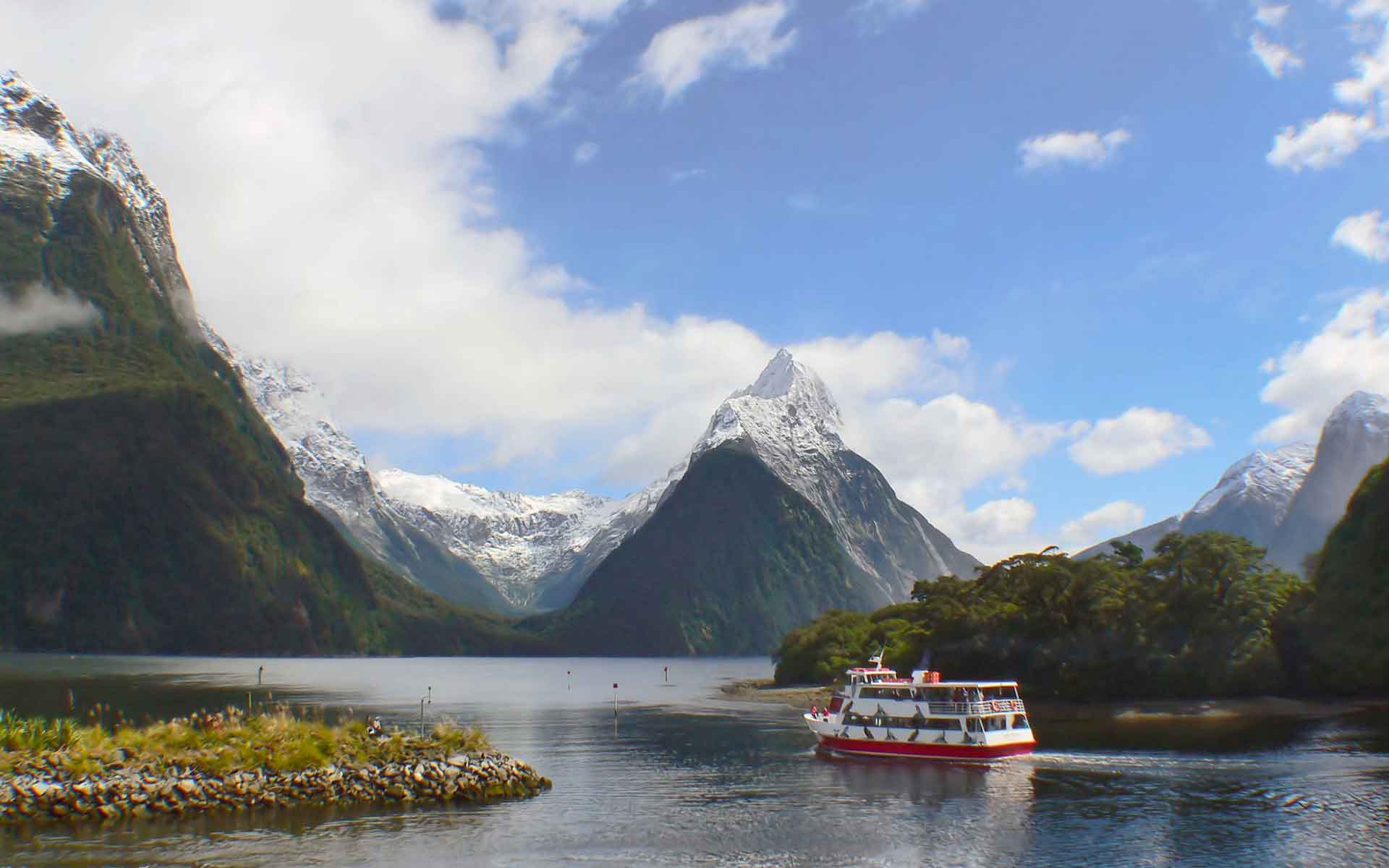
Annually one million tourists visit Milford Sound and marvel at Mitre Peak’s (1683 meters) glacial horn. The fjord’s cliffs tower 1500-2000 meters. Photo: Bernhard Spragg.
Geological Period
Quaternary
Main geological interest
Geomorphology and active geological processes
Igneous and Metamorphic petrology
Location
Southland, New Zealand
44°38’10”S, 167°53’38”E
Annually one million tourists visit Milford Sound and marvel at Mitre Peak’s (1683 meters) glacial horn. The fjord’s cliffs tower 1500-2000 meters. Photo: Bernhard Spragg.
Globally significant examples of spectacular fjords, deeply carved by glaciers through gneissic rocks uplifted high along a convergent plate boundary.
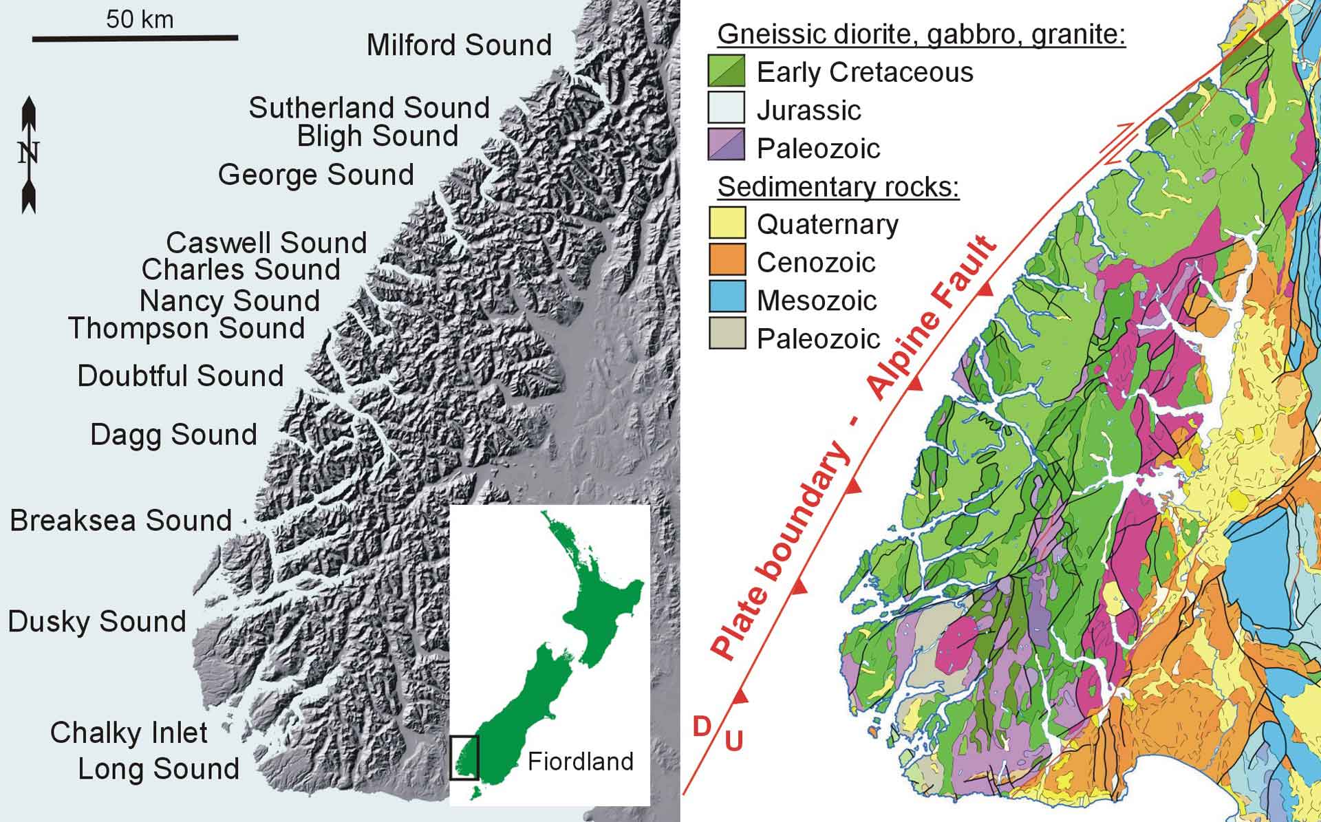
Fiordland has fourteen exemplary examples of fjords. Key features include: proximity to collisional plate boundary (subduction and strike slip) producing 1000-3000 meters of uplift in last 7 Ma; uplift balanced by subaerial erosion of uplifted mountains; massive annual precipitation (today up to 7 meters), producing glaciers up to 2 kilometers thick in glacials and unique marine environment and biota beneath freshwater surface layer today; spectacular waterfalls from hanging valleys; over-deepening of upstream basins and silled-mouths made of bedrock and terminal moraine; fjord basin sediment archives of post-glacial history, climate and sea-level rise; world’s highest sea cliffs (~2000 meters) (Hayward, 2022).
- Geological description
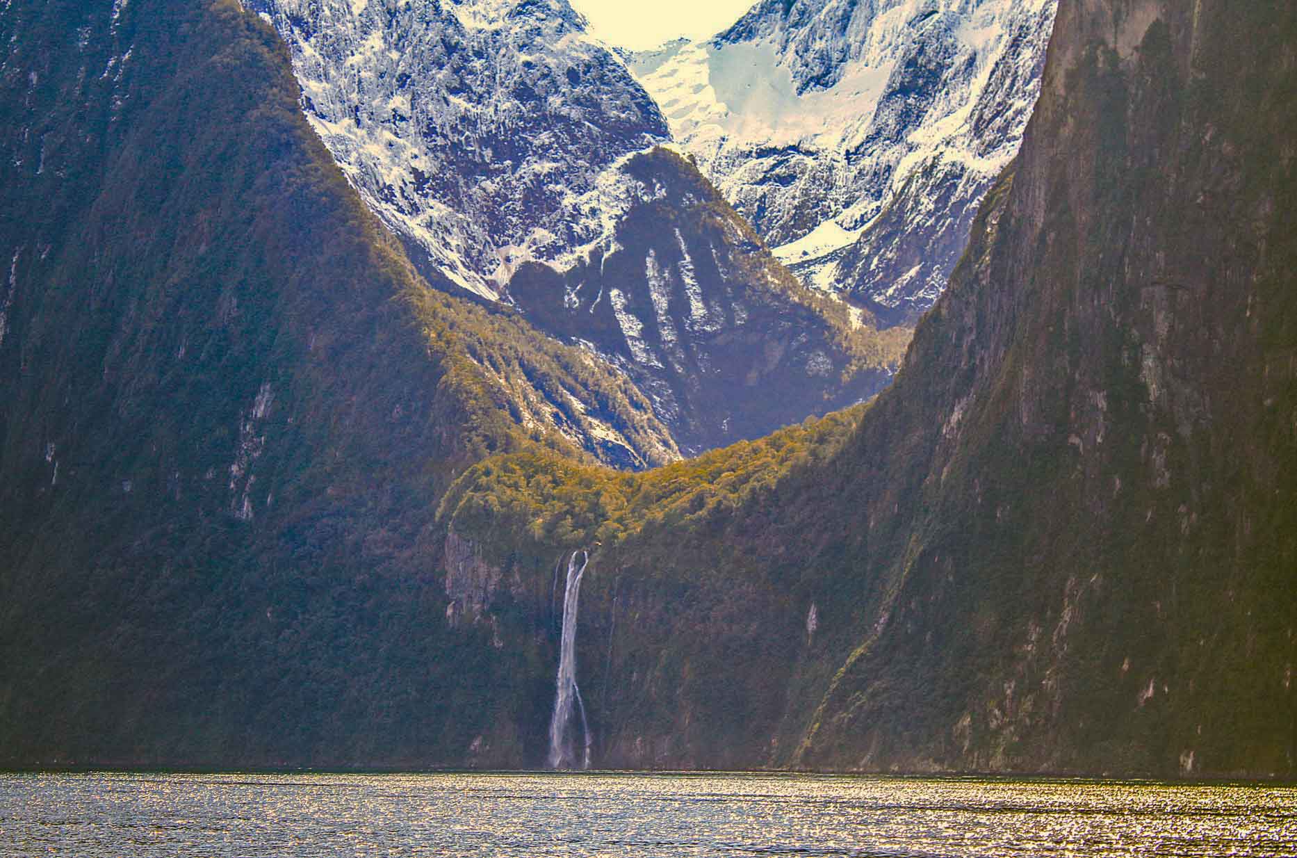
Fiordland is in Te Wahipounamu – South West New Zealand World Heritage Area characterised by uplifted snowy mountains and deeply incised glacial valleys. There are 14 marine-flooded fjords, each 10-40 kilometers long with internal basins (200-420 meters deep) and shallow sills (40-120 meters deep) at their seaward mouths. The fjords were river valleys widened and deepened by glacial erosion during Quaternary glacial periods. The glaciers cut deeply into hard crystalline plutonic and metamorphic rocks that were once buried to depths of 10-30 kilometers. A mid-Cenozoic erosion surface has been uplifted in the last 7 Ma along the east side of the Australia-Pacific plate boundary (combination of eastward subduction and oblique dextral displacement at the southern end of the Alpine Fault). Glacial erosion of the uplifted surface has resulted in numerous sharp peaks rising from 1000 meters in the south to 2700 meters in the north. The west-flowing glaciers have carved classical straight, U-shaped valleys with spectacular glacially-striated vertical rock faces and numerous hanging tributary valleys and high waterfalls. Extreme rainfall gives Fiordland the name “Land of Waterfalls” and produces a thick freshwater layer on the surface of fjords. Post-glacial fjord sediments record switch from freshwater to marine environment (Dykstra, 2012).
- Scientific research and tradition
Fiordland research includes studies on: complexity of Paleozoic and Mesozoic fault blocks and intrusions identified and mapped (Turnbull et al., 2010); plate boundary structure and seismic impacts (Klepeis et al., 2019); fjord sediment archives of climate, sea level (Dlabola et al., 2015); offshore Quaternary sediment processes (Strachan et al., 2016).
- Reference
Dlabola, E.K. et al. (2015) ‘A post-glacial relative sea-level curve from Fiordland, New Zealand’, Global and Planetary Change, 131, pp. 104–114. Available at: https://doi.org/10.1016/j.gloplacha.2015.05.010.
Dykstra, J.L. (2012) The Post-LGM Evolution of Milford Sound, Fiordland, New Zealand: Timing of Ice Retreat, the Role of Mass Wasting & Implications for Hazards. PhD thesis. University of Canterbury. Geological Sciences. Available at: https://ir.canterbury.ac.nz/handle/10092/9282.
Hayward, B.W. (2022) ‘Piopiotahi / Milford Sound; Deep glacier-carved valley drowned by sea level rise after the Last Ice Age’, in Mountains, Volcanoes, Coasts and Caves: Origins of Aotearoa New Zealand’s natural wonders. Auckland University Press, p. 384.
Klepeis, K.A. et al. (2019) ‘The Age and Origin of Miocene-Pliocene Fault Reactivations in the Upper Plate of an Incipient Subduction Zone, Puysegur Margin, New Zealand’, Tectonics, 38(8). Available at: https://doi.org/10.1029/2019TC005674.
Strachan, L.J. et al. (2016) ‘Non-cohesive silt turbidity current flow processes; insights from proximal sandy-silt and silty-sand turbidites, Fiordland, New Zealand’, Sedimentary Geology, 342, pp. 118–132. Available at: https://doi.org/10.1016/j.sedgeo.2016.06.017.
Turnbull, I.M., Allibone, A.H. and Jongens, R. (2010) Geology of the Fiordland area, 1:250,000 geological map 17. Institute of Geological and Nuclear Sciences. Available at: https://natlib.govt.nz/records/30190164.
- Author(s)
Bruce W Hayward.
Geoscience Society of New Zealand.
Jill A Kenny.
Geoheritage Subcommittee, Geoscience Society of New Zealand.


