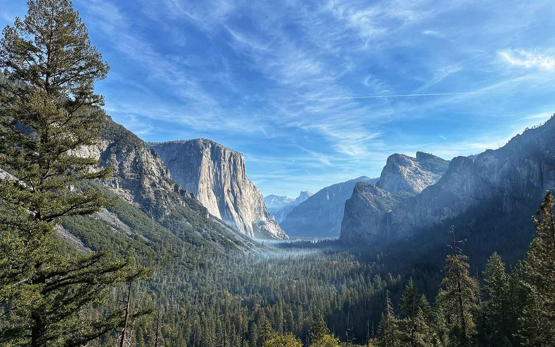
Yosemite Valley from Tunnel View. (Will Parrinello, Mill Valley Film Group).
Geological Period
Neogene to Quaternary
Main geological interest
Geomorphology and active geological processes
Location
Sierra Nevada, United States of America
37°44’30”N, 119°34’12”W
Yosemite Valley from Tunnel View. (Will Parrinello, Mill Valley Film Group).
Archetypal glacial landforms inset into spectacular mountainous granite topography.
Yosemite Valley is a classic, most impressive example of glacial landforms resulting from mountain glaciation, as well as of granite landforms, with relationships between joint patterns and landform shapes clearly exposed (Matthes, 1930; Graham, 2012). The Half Dome, Royal Arches and El Capitan are reference structural granite landforms, shown in many textbooks. Pioneering studies of linkages between uplift and erosion (Stock et al., 2005), factors influencing the magnitude of glaciation, and rockfall-triggering mechanisms (Collins and Stock, 2016) were executed in Yosemite. The sheer scale of landforms can be appreciated from numerous vantage points, including the globally famous Glacier Point.
- Geological description
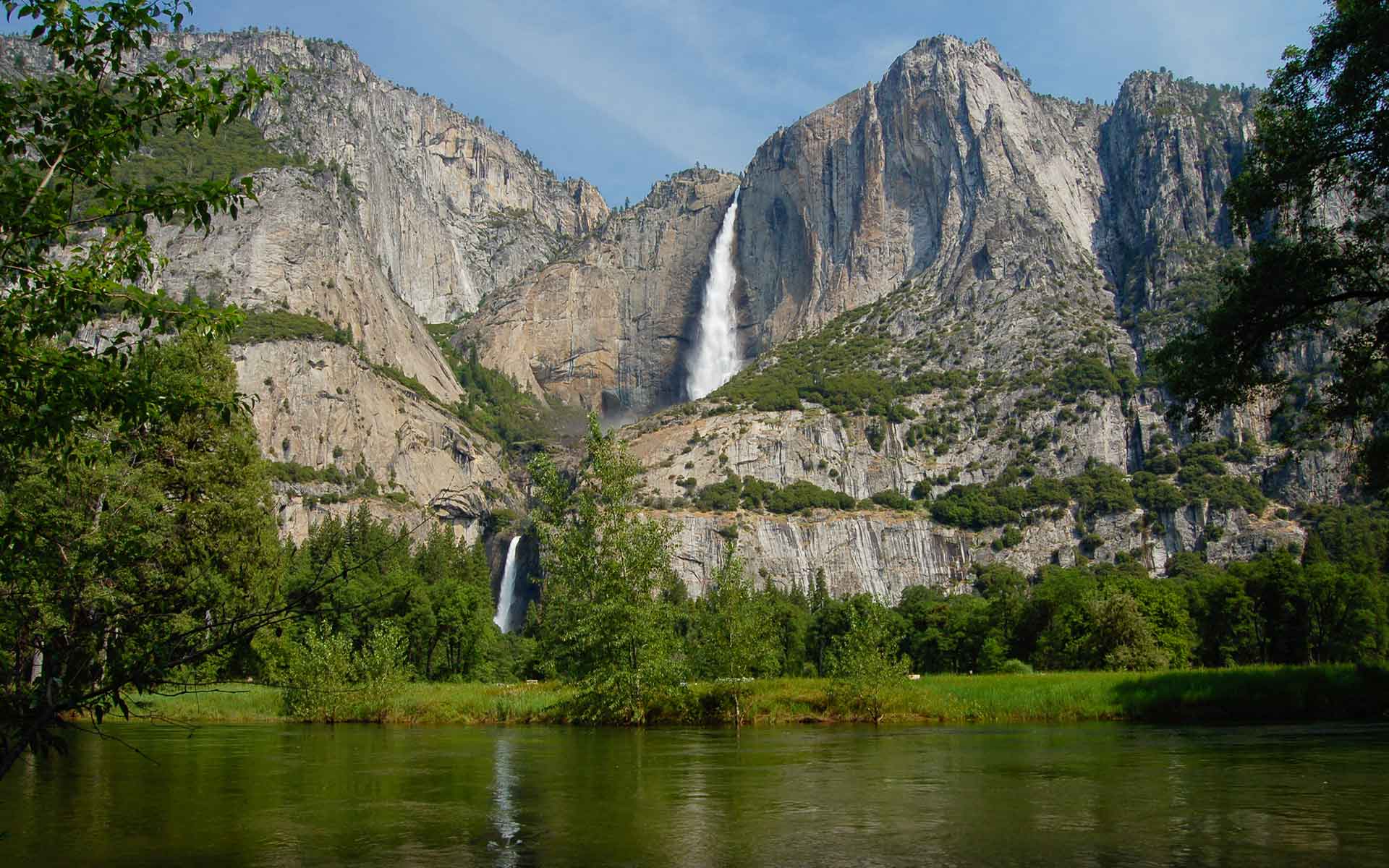
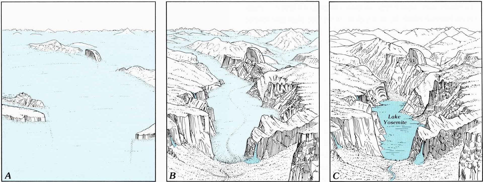
Yosemite Valley is located within the western slope of the Sierra Nevada range, which was subject to considerable asymmetric uplift in the Neogene and Quaternary. Uplift triggered massive erosion, resulting in the origin of valleys several kilometres deep, but undulating surfaces survived along water divides, creating spectacular landscape contrast. Geologically, Yosemite Valley is carved in granites and granodiorites of Cretaceous age, cut by numerous dikes. Jointing exerts evident control on the shape of many landforms, including the famous domes and blind arches. In the Quaternary, high elevation coupled with the location on the windward side, exposed to moist air masses arriving from the Pacific, allowed for the development of extensive mountain glaciation. An ice cap formed over the plateau, carving cirques, whereas long ice tongues descended into the valleys, transforming them into impressive U-shaped glacial troughs. Different intensity of glacial erosion between the trunk and tributary valleys resulted in the origin of hanging valleys and spectacular waterfalls, among the highest on Earth. Evidence of glaciation also includes ice-polished surfaces, roche-moutonnées, moraines and lake basins. Yosemite Valley remains geomorphologically very active, with rockfalls and rockslides being the most visible processes transforming glacial morphology complemented by bedrock abrasion and gravel-bed river erosion.
- Scientific research and tradition
The history of coordinated geological research in Yosemite goes back to 1913 (Huber, 1989), and the area has become a natural laboratory to investigate granite geology, granite landforms, uplift-erosion interactions and glacial landforms (Graham, 2012). It yielded many landmark studies and research continues, benefitting from excellent exposures and great landforms.
- Reference
Collins, B.D. and Stock, G.M. (2016) ‘Rockfall triggering by cyclic thermal stressing of exfoliation fractures’, Nature Geoscience, 9(5), pp. 395–400. Available at: https://doi.org/10.1038/ngeo2686.
Graham, J.P. (2012) Yosemite National Park: geologic resources inventory report. NPS/NRSS/GRD/NRR–2012/560. Denver, CO : Fort Collins, Colorado: National Park Service, Geologic Resources Division ; U.S. Department of the Interior, National Park Service, Natural Resource Stewardship and Science, p. 70. Available at: https://irma.nps.gov/DataStore/DownloadFile/453731.
Huber, N.K. (1987) The geologic story of Yosemite National Park, Bulletin. 1595. U.S. Government Printing Office. Available at: https://doi.org/10.3133/b1595.
Matthes, F.E. (1930) Geologic history of the Yosemite Valley, Professional Paper. 160. U.S. Geological Survey. Available at: https://doi.org/10.3133/pp160.
Stock, G.M., Anderson, R.S. and Finkel, R.C. (2005) ‘Rates of erosion and topographic evolution of the Sierra Nevada, California, inferred from cosmogenic 26Al and 10Be concentrations’, Earth Surface Processes and Landforms, 30(8), pp. 985–1006. Available at: https://doi.org/10.1002/esp.1258.
- Author(s)
Piotr Migoń.
Institute of Geography and Regional Development, University of Wrocław, Wrocław, Poland.
Olav Slaymaker.
Department of Geography, University of British Columbia, Vancouver, Canada.

