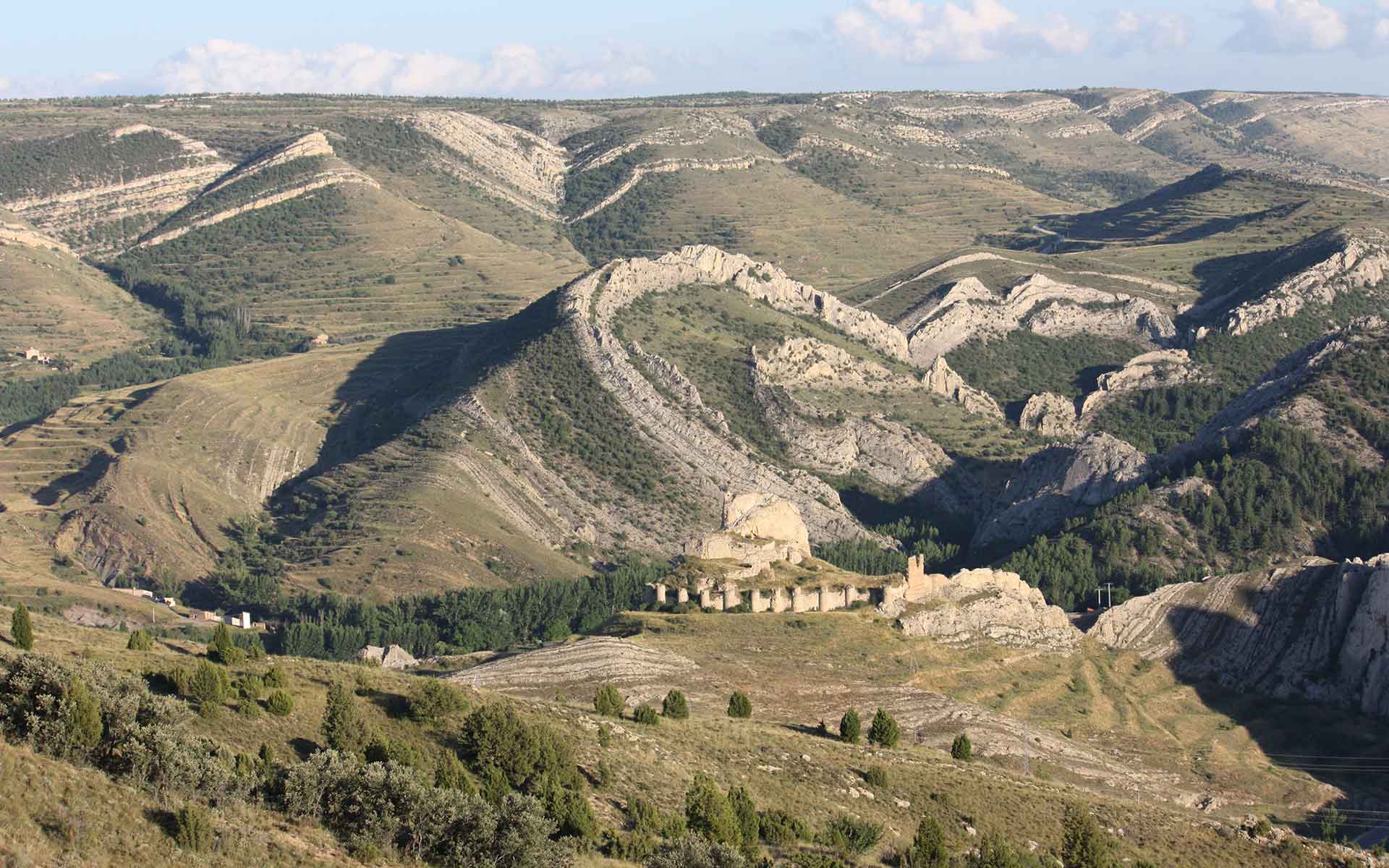
La Olla anticline, second-generation vertical-axis fold affecting Lower Cretaceous marine formations. In front: Aliaga medieval castle. Horizon: Late Neogene planation surface.
Probably the largest and most original example of superposed buckle folding reported in the world.
The superposed folds of Aliaga (Iberian Chain, Spain) represent a global reference for this type of tectonic structures. Most of them correspond to geometries reproduced in laboratory analogue models, but no other comparable large-scale real examples have been described. Among them, a number of vertical, ‘snake-like’ folds constitute a singular type of fold interference, as well as a case of erosion-driven tectonic structure. It shows how earth-surface processes can exert a control on fold geometry. The most representative structure, La Olla anticline, is the icon of the Geological Park of Aliaga, embryo of the Maestrazgo Unesco Global Geopark.
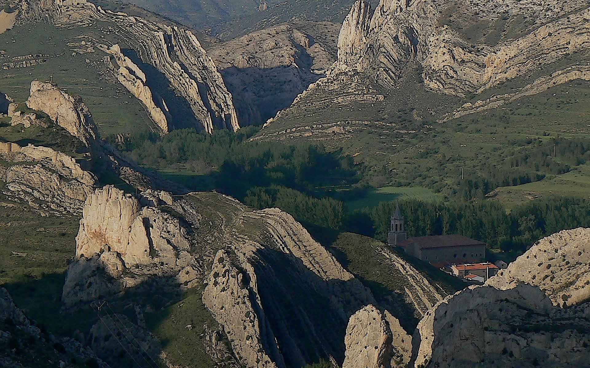
Multiple refolded vertical beds in the surroundings of Aliaga. Sharp, convulsing limestone crests represent a magnificent example of structural landforms and geological landscape.
Geological description
The Aliaga area exhibits a complete inventory of large-scale examples of superposed buckle folds deforming the Mesozoic-Cenozoic cover. They resulted from successive, diversely oriented contractional episodes developed during the Alpine Orogeny, which caused inversion of a series of extensional Mesozoic basins and built the intraplate Iberian Chain (NE Spain).
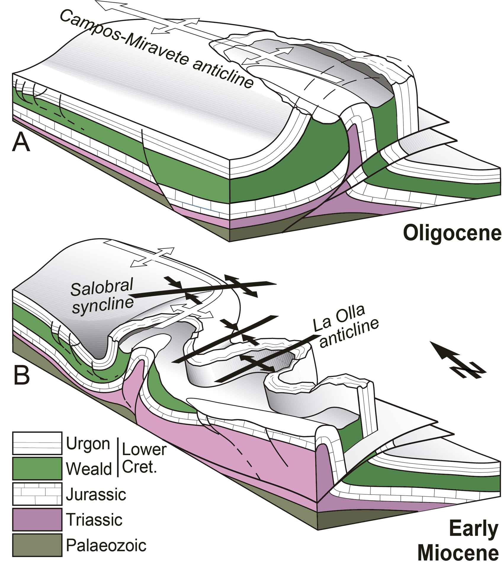
ENE-WSW trending buckle folds (Early Miocene in age) are superposed to a large NNW-SSE anticline (Eocene-Oligocene). North of Aliaga, the earlier hinge zone in the competent unit controlling buckling (Urgon facies, Lower Cretaceous marine limestones) constituted a mechanical obstacle to refolding. This induced development of conical second-generation folds that buckle the hinges and axial surfaces of the former ones in a complex manner. On the contrary, to the south, erosional removal of the hinge zone allowed the vertical eastern limb to behave almost independent, being refolded into cylindric, nearly vertical folds, as La Olla anticline. Lower Miocene conglomerates adjacent to the earlier NNW-SSE trending anticline contain pebbles of Jurassic origin, whose source area was the fold core. This evidences that the latter had been effectively exhumed before refolding.
Scientific research and tradition
These folds were first described by Simón (1980) and later analysed in detail by Simón (2004, 2005). They are the object of numerous scientific and educational publications and activities: e.g., Geological Park of Aliaga guidebook (Simón et al., 1998); Practical Geology Course of the Teruel Summer University. La Olla anticline provides the cover image for the popular textbook by R. J. Lisle “Geological structures and maps: A practical guide” (Butterworth-Heinemann, 2020), as it provided for its first edition (Pergamon Press, 1988).
Block diagrams showing folding sequence in Aliaga. (A) First-generation, NNW-SSE trending anticline. (B) Second-generation folds with vertical axes and ENE-WSW striking axial planes (after Simón, 2005).
Reference
Arenas, C. et al. (1998) Guía del Parque Geológico de Aliaga. Edited by J.L. Simón. Ayto. de Aliaga – CEDEMATE – Dpto. de Geología, Universidad de Zaragoza.
Lisle, R.J. (2020) Geological Structures and Maps: A Practical Guide. Fourth Edition. Oxford, United Kingdom ; Cambridge, MA.
Simón, J.L. (1980) ‘Estructuras de superposicion de plegamientos en el borde NE de la cadena Ibérica’, Acta geológica hispánica, 15(5), pp. 137–140.
Simón, J.L. (2004) ‘Superposed buckle folding in the eastern Iberian Chain, Spain’, Journal of Structural Geology, 26(8), pp. 1447–1464. Available at: https://doi.org/10.1016/j.jsg.2003.11.026.
Simón, J.L. (2005) ‘Erosion-controlled geometry of buckle fold interference’, Geology, 33(7), pp. 561–564. Available at: https://doi.org/10.1130/G21468.1.
Author(s)
José Luis Simón Gómez.
Department of Earth Sciences, Zaragoza University, Spain.
Luis Alcalá Martínez.
Parque de las Ciencias de Andalucía, Granada, Spain.