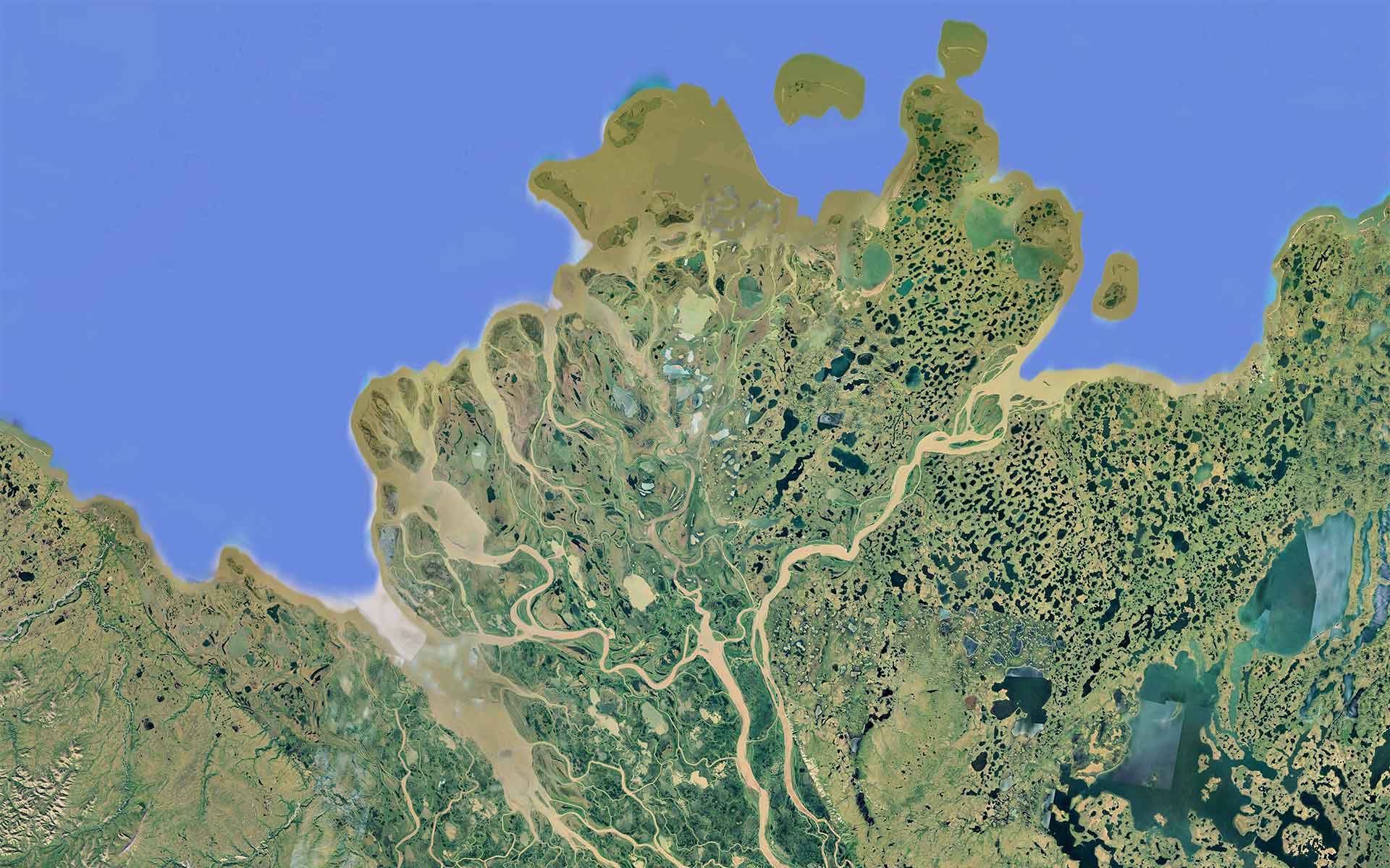
The Mackenzie Delta is the most spectacular scenery in the Arctic. Dark green: delta, light green: uplands, beige: suspended sediments in channels, grey: lakes.
Geological Period
Quaternary
Main geological interest
Geomorphology and active geological processes
Location
Interior Plains, Northwest Territories, Canada
68°43’01”N, 132°39’45”W
The Mackenzie Delta is the most spectacular scenery in the Arctic. Dark green: delta, light green: uplands, beige: suspended sediments in channels, grey: lakes.
Complex coastal landforms of diverse origin: glacial, permafrost, fluvial, and pseudokarst in the north-west Canadian Arctic.
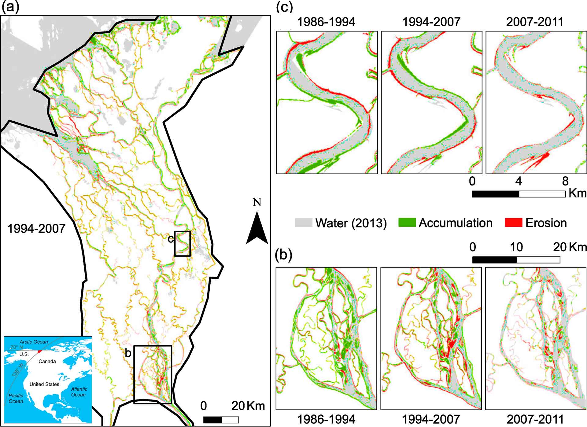
The Mackenzie Delta (13,000 km2; the second largest Arctic delta) is the best example of a complex landscape combining forms of different origins from post-glacial rocky islands through permafrost-related landforms such as polygons and pingos to contemporary pseudokarst lakes, slumps and numerous migrating channels carrying huge bedloads and suspended sediment (Carson et al., 1998; Burn, 2010, 2017). Sedimentation rates over much of the outer delta are less than the rate of subsidence associated with sea-level rise. Permafrost is ubiquitous and the surrounding landscape testifies to the enormous forces that can be unleashed by seasonal freezing and thawing of the ground.
- Geological description
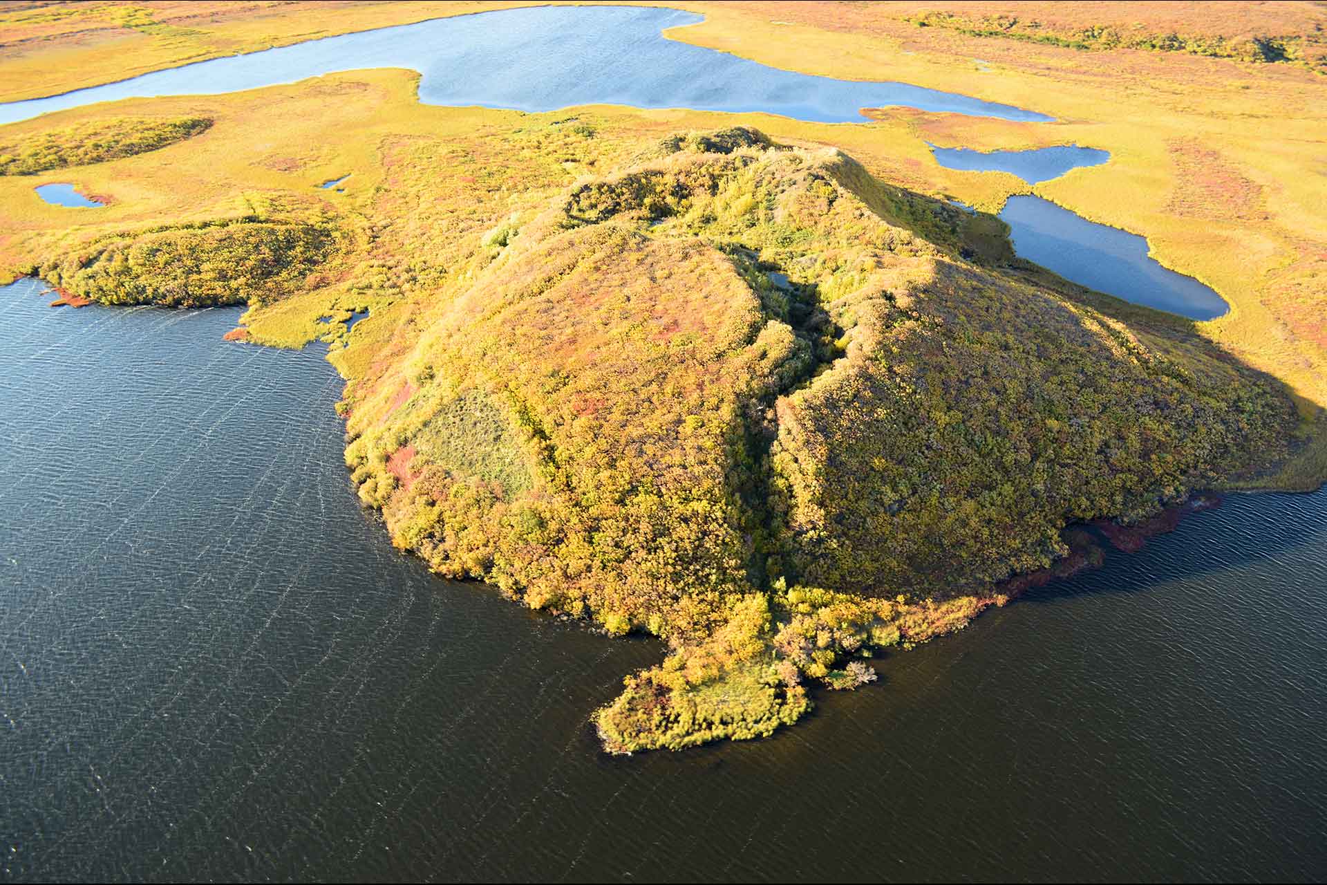
The maximum extent of the Laurentide Ice Sheet in the Mackenzie Delta area was 30,000 years ago. The vast delta, with its branching channels, ponds and wetlands, covers more than 13,000 km2 of alluvial coastal plain. The delta stretches nearly 210 kilometers from north to south and is 50 to 80 kilometers wide. Below Fort McPherson, the Mackenzie River divides into several major channels and hundreds of smaller tributaries, the largest of which flows north-northeast and empties into the Beaufort Sea west of Tuktoyaktuk. The Mackenzie Delta is a labyrinth of shifting channels and pseudokarst lakes. Most of the land in the delta is permafros. Bedrock is at great depth, and patches or taliks of unfrozen ground are controlled by shifting channels. Retrogressive thaw slumps, up to 200 meters wide, are common where ground ice is exposed by bank erosion. Rivers and lakes are ice-covered for more than half the year. The Mackenzie River carries a large load of sediment, transporting about 128 million tonnes to its delta each year. A characteristic feature of the delta are the numerous pingos (1400, the largest population in the world). They are conical, ice-cored, 50 meters high, and >100 meters in diameter at the base.
- Scientific research and tradition
The Mackenzie Delta is the best-studied of the polar regions. Especially the research and field experiments of J. R. Mackay (1998) have contributed to the understanding of permafrost phenomena. The Mackenzie Delta is the most spectacular geoecological landscape in the Arctic, which is nourished by the annual flooding of the Mackenzie River.
- Reference
Burn, C.R. (2010) ‘The Mackenzie Delta: An Archetypal Permafrost Landscape’, in P. Migon (ed.) Geomorphological Landscapes of the World. Dordrecht: Springer Netherlands, pp. 1–12. Available at: https://doi.org/10.1007/978-90-481-3055-9_1.
Burn, C.R. (2017) ‘Mackenzie Delta: Canada’s Principal Arctic Delta’, in O. Slaymaker (ed.) Landscapes and Landforms of Western Canada. Cham: Springer International Publishing (World Geomorphological Landscapes), pp. 321–334. Available at: https://doi.org/10.1007/978-3-319-44595-3_23.
Carson, M.A., Jasper, J.N. and Conly, F.M. (1998) ‘Magnitude and Sources of Sediment Input to the Mackenzie Delta, Northwest Territories, 1974-94’, ARCTIC, 51(2), pp. 116–124. Available at: https://doi.org/10.14430/arctic1053.
Mackay, J. (1998) ‘Pingo Growth and collapse, Tuktoyaktuk Peninsula Area, Western Arctic Coast, Canada: a long-term field study’, Géographie physique et Quaternaire, 52(3), pp. 271–323. Available at: https://doi.org/10.7202/004847ar.
Vesakoski, J.-M. et al. (2017) ‘Arctic Mackenzie Delta channel planform evolution during 1983–2013 utilising Landsat data and hydrological time series’, Hydrological Processes, 31(22), pp. 3979–3995. Available at: https://doi.org/10.1002/hyp.11315.
- Author(s)
Zbigniew Zwoliński.
Institute of Geoecology and Geoinformation, Adam Mickiewicz University in Poznań, Poland.

