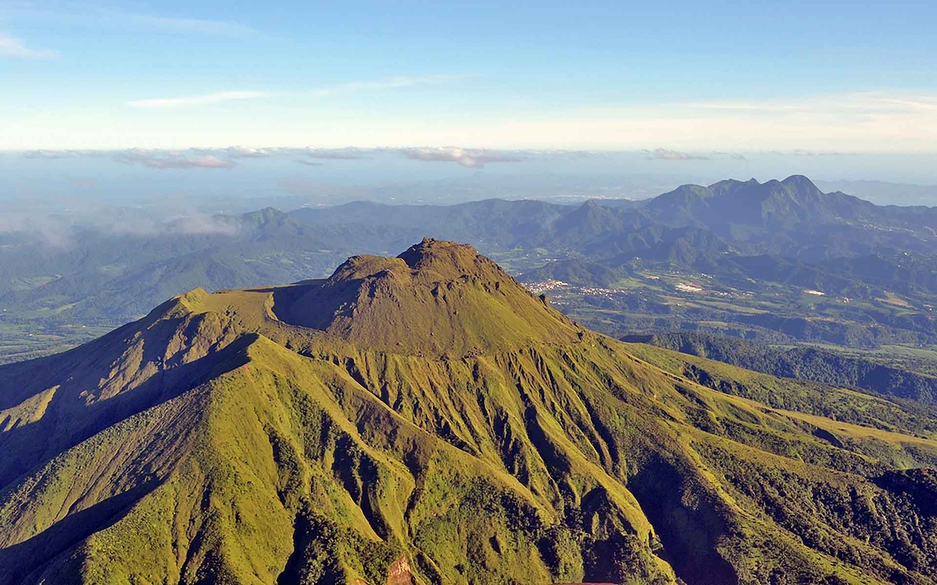
Montagne Pelée, active volcano in Martinique Island (© Cyprien Lesage).
Geological Period
Pleistocene to Holocene
Main geological interest
History of geosciences
Volcanology
Location
Martinique Island, France
14°48’34”N, 061°09’59”W
Montagne Pelée, active volcano in Martinique Island (© Cyprien Lesage).
Montagne Pelée is the world reference volcano for the Peléan type eruption, firstly described by Alfred Lacroix in 1902.
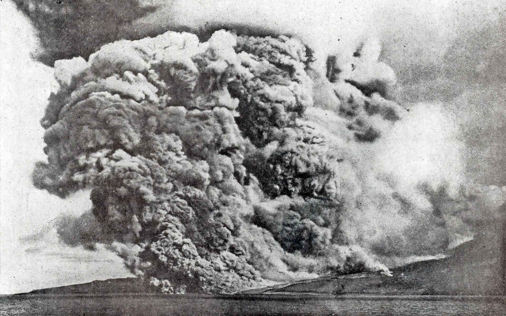
Montagne Pelée is one of the most famous volcanoes worldwide with alternating Plinian and dome-forming eruptions and huge flank-collapse events. Montagne Pelée raised the issue of the explosivity of dome-forming eruptions, especially the May 8, 1902 killer eruption which was the first described as Peléan by Alfred Lacroix (1904) who also introduced the term “nuée ardente” (pyroclastic flow). This catastrophic eruption paved the way for the creation of the Volcanological and Seismological Observatory of Martinique in 1903, the second in the world after the Vesuvius Observatory in 1841.
- Geological description
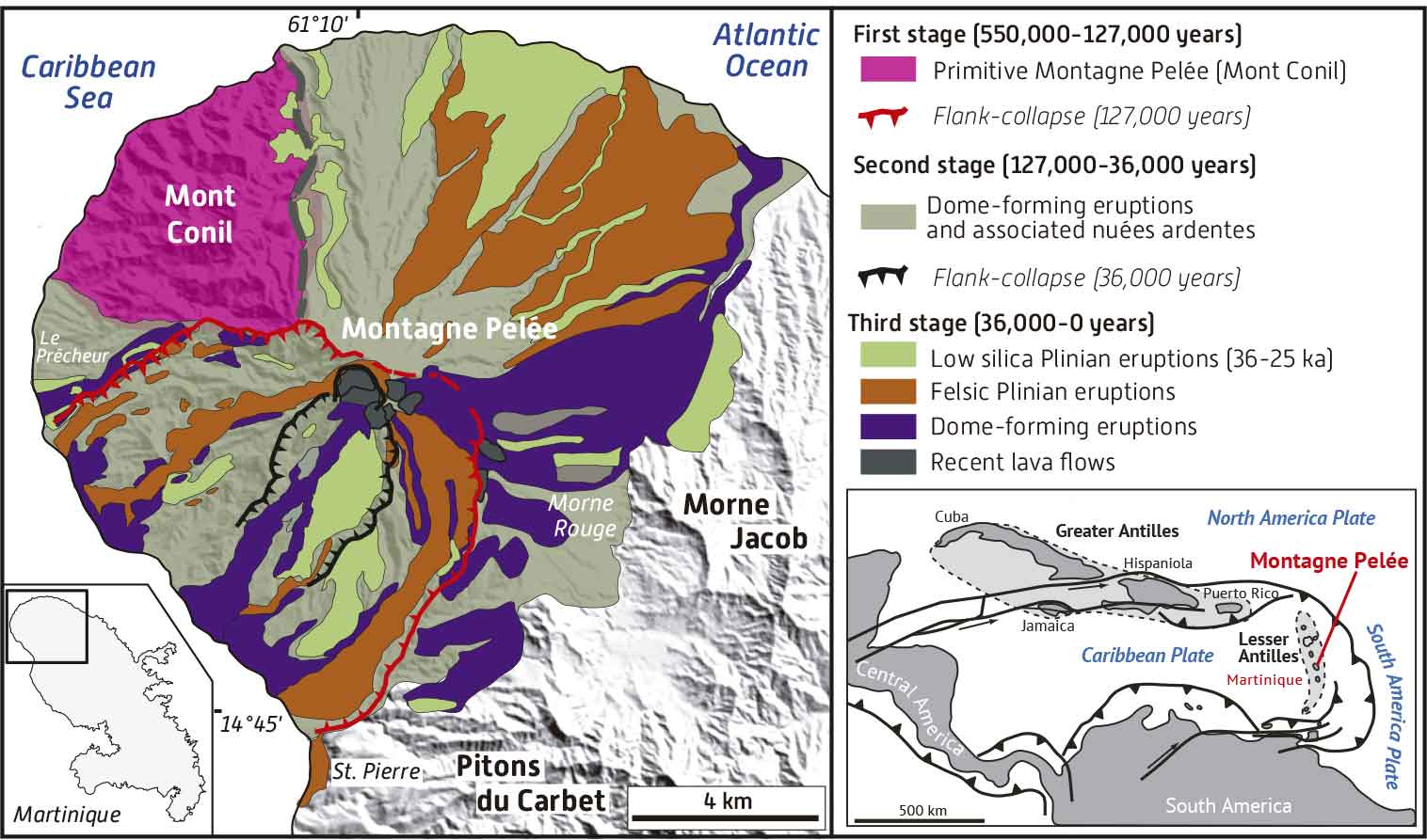
The Montagne Pelée is a typical island-arc calc-alkaline volcano (1397 m high), located in the northern part of Martinique Island. It is one of the most active and dangerous volcanoes in the Lesser Antilles arc. Three main stages are now considered in literature separated by two major flank-collapse events (Le Friant et al., 2003; Germa et al., 2015; Boudon and Balcone-Boissard, 2021 and references therein). The first stage of edification (550,000-127,000 years), also called the primitive Montagne Pelée, corresponds to lava flows and lava domes building the Mount Conil and followed by a consequent flank-collapse event. The second stage activity (127,000-36,000 years) is marked by dominant lava dome-forming eruptions and associated concentrated pyroclastic density currents (nuées ardentes). A second flank-collapse initiated the third stage (36,000 years-Today). The volcano activity is largely characterised by alternating Plinian and dome-forming eruptions, primarily involving andesitic magmas. Pyroclastic deposits are dominant compared to massive lavas. The total cumulative erupted volume for Montagne Pelée is estimated at ca. 72 km3 (Germa et al., 2015). The most devastating eruption occurred in 1902 and caused the destruction of the towns of Saint-Pierre and Morne Rouge and the death of 30,000 people (Lacroix, 1904).
- Scientific research and tradition
Since Alfred Lacroix (1904), Montagne Pelée has been studied extensively. Land based and offshore studies have been published in numerous scientific papers (see Boudon and Balcone-Boissard (2021) for a review). This geosite is included in the French National Geoheritage Inventory and in the UNESCO World Heritage List.
- Reference
Boudon, G. and Balcone-Boissard, H. (2021) ‘Volcanological evolution of Montagne Pelée (Martinique): A textbook case of alternating Plinian and dome-forming eruptions’, Earth-Science Reviews, 221, p. 103754. Available at: https://doi.org/10.1016/j.earscirev.2021.103754.
Germa, A., Lahitte, P. and Quidelleur, X. (2015) ‘Construction and destruction of Mont Pelée volcano: Volumes and rates constrained from a geomorphological model of evolution’, Journal of Geophysical Research: Earth Surface, 120(7), pp. 1206–1226. Available at: https://doi.org/10.1002/2014JF003355.
Lacroix, A. (1904) La Montagne Pelée et ses éruptions. Paris: Masson.
Le Friant, A. et al. (2003) ‘Large-scale flank collapse events during the activity of Montagne Pelée, Martinique, Lesser Antilles’, Journal of Geophysical Research: Solid Earth, 108(B1). Available at: https://doi.org/10.1029/2001JB001624.
Westercamp, D. et al. (1989) ‘Carte géologique à 1/50 000 de la Martinique’. BRGM, 246 p.
- Author(s)
Nicolas CHARLES.
PhD – BRGM / French Geological Survey.

