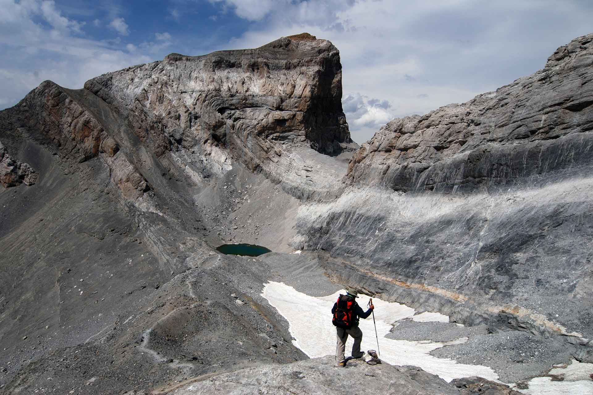
Fold and thrust of the Cilindro de Marboré, one of the most iconic images of the Monte Perdido massif.
Geological Period
Eocene to Oligocene
Main geological interest
Tectonics
Stratigraphy and sedimentology
Location
Pyrenees, Spain
42°40’15”N, 000°04’02”E
Fold and thrust of the Cilindro de Marboré, one of the most iconic images of the Monte Perdido massif.
A key site for understanding the relations between sedimentation and deformation in mountain building processes.
It is a world reference for analysing the relationships between the orogenic growth of a mountain range and the sedimentation and deformation in a synorogenic basin. The outcrop conditions are exceptional, showing the spectacular stacking of tectonic structures left exposed by glacial erosion. The stratigraphic record spans 35 million years in a single succession more than 1500 metres thick partly contemporary with the uplift of the mountain range. The representativeness of the regional and global stratigraphic changes of these series make this succession a world reference. It is a UNESCO World Heritage Site, a Biosphere Reserve and a Global Geopark.
- Geological description
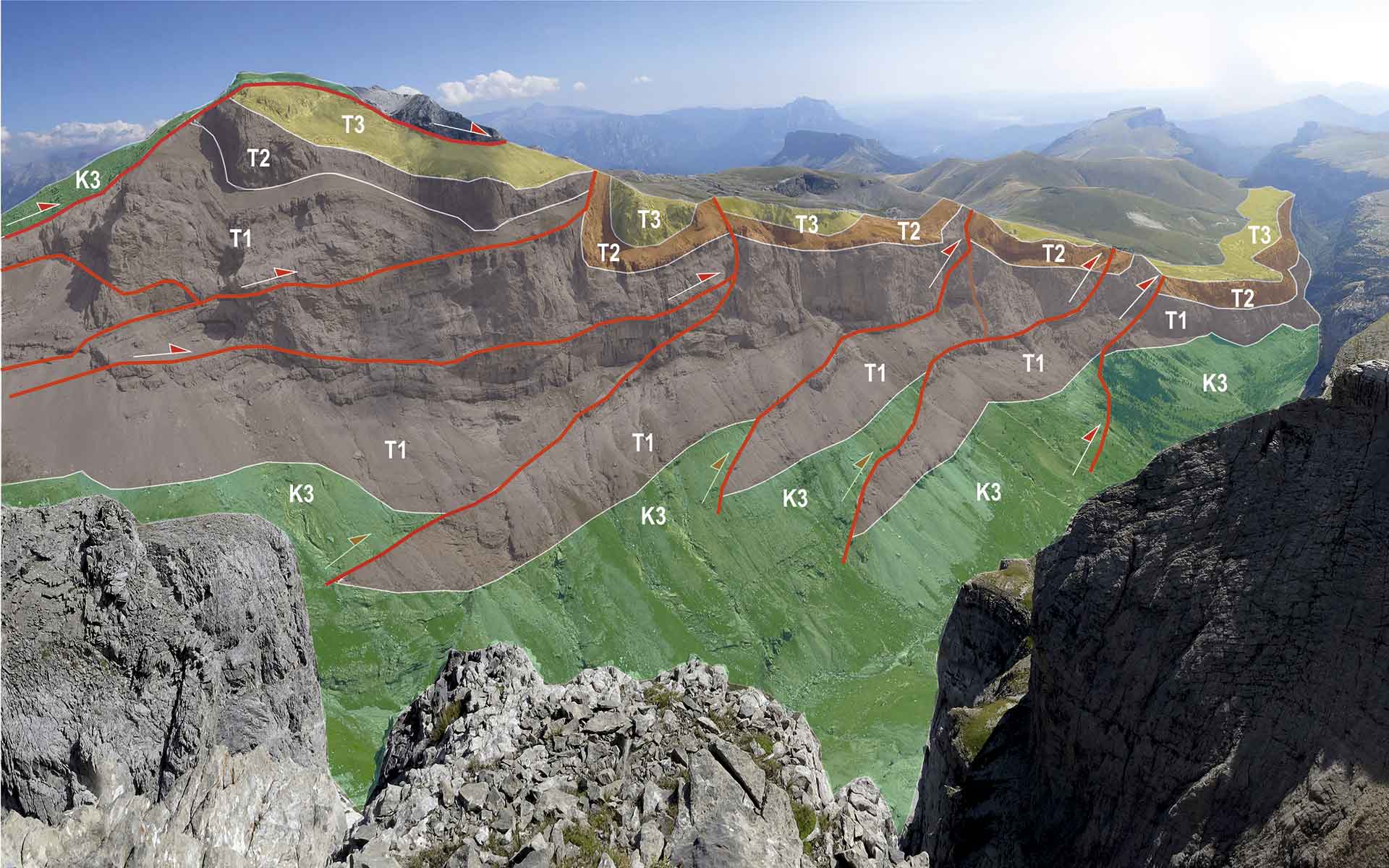
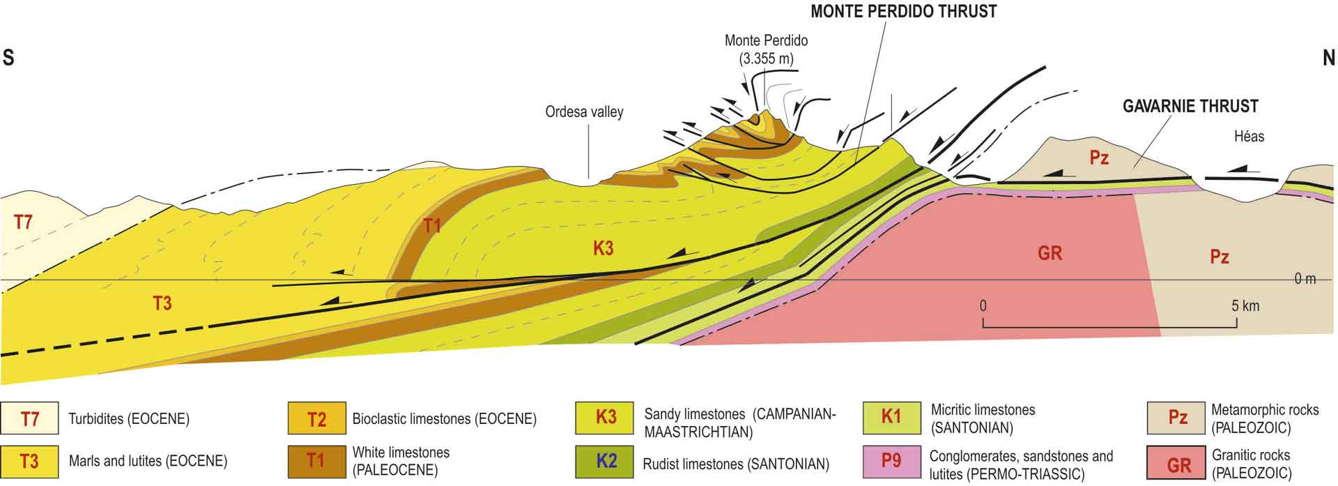
In the Monte Perdido massif, the Gavarnie thrust together with the Monte Perdido system are the main structure responsible for the Pyrenees as a mountain belt, but also it is the generator or part of the subsidence that made possible the existence of the South Pyrenean synorogenic basin (Seguret, 1972). The spectacular fold and thrust stack of Monte Perdido system is partly responsible for producing the highest limestone massif in Western Europe. It includes rocks from Paleozoic to Paleogene as part of the Gavarnie thrust footwall; Devonian rocks compose the hangingwall (Rousell, 1904; Van der Velde, 1967).
The Monte Perdido system formed during the Lutetian to Bartonian (Eocene) (Pujalte et al., 2016). It is composed of several sheets affecting rocks from upper Cretaceous to Eocene. The entire system was folded during the displacement of the Gavarnie thrust, from Bartonian to Rupelian (Oligocene) (Labaume et al., 2016). Due to this major structural feature, the Monte Perdido system is tilted to the south and is the southern flank of a great anticlinal of regional scale (Muñoz et al., 2013).
The transfer of deformation to the south associated with the Gavarnie thrust is related to the generation of important folds and syntectonic sediments located in the South Pyrenean synorogenic basin.
- Scientific research and tradition
Research started early, as Charles Lyell was here in 1830 and in 1903. The first thrust in the Pyrenees was here identified. After that, the main geologists who have dealt with the sedimentary record and tectonics of the Pyrenean mountain belt have worked in the area and research continues today.
- Reference
Labaume, P. et al. (2016) ‘Tectonothermal history of an exhumed thrust-sheet-top basin: An example from the south Pyrenean thrust belt: JACA THRUST-SHEET-TOP BASIN’, Tectonics, 35(5), pp. 1280–1313. Available at: https://doi.org/10.1002/2016TC004192.
Muñoz, J.-A. et al. (2013) ‘The Ainsa Fold and thrust oblique zone of the central Pyrenees: Kinematics of a curved contractional system from paleomagnetic and structural data’, Tectonics, 32(5), pp. 1142–1175. Available at: https://doi.org/10.1002/tect.20070.
Pujalte, V. et al. (2016) ‘A siliciclastic braid delta within a lower Paleogene carbonate platform (Ordesa-Monte Perdido National Park, southern Pyrenees, Spain): Record of the Paleocene–Eocene Thermal Maximum perturbation’, Palaeogeography, Palaeoclimatology, Palaeoecology, 459, pp. 453–470. Available at: https://doi.org/10.1016/j.palaeo.2016.07.029.
Roussel, J. (1904) ‘Tableau Stratigraphique des Pyreénées’, Bull Carte Géol. Fra, 1(97), pp. 1–119.
Seguret, M. (1972) Etude tectonique des nappes et séries décollées de la partie centrale du versant sud des Pyrénées : caractère synsédimentaire, rôle de la compression et de la gravité. Montpellier: Universite des Sciences et Techniques du Languedoc (Publication Ustela).
Van de Velde, E.J. (1968) ‘Geology of the Ordesa overthrust mass, Spanish Pyrenees, Province of Huesca’, Estudios Geologicos, 23(3–4), pp. 163–201.
- Author(s)
Ruth Soto Marín.
Geological and Mining Institute of Spain (IGME, CSIC).
Oriol Oms Llobet.
Universitat Autònoma de Barcelona. Spain.
Ánchel Belmonte Ribas.
Sobrarbe-Pirineos UNESCO Global Geopark. Spain.

